Naturalist Notes
April 11, 2022
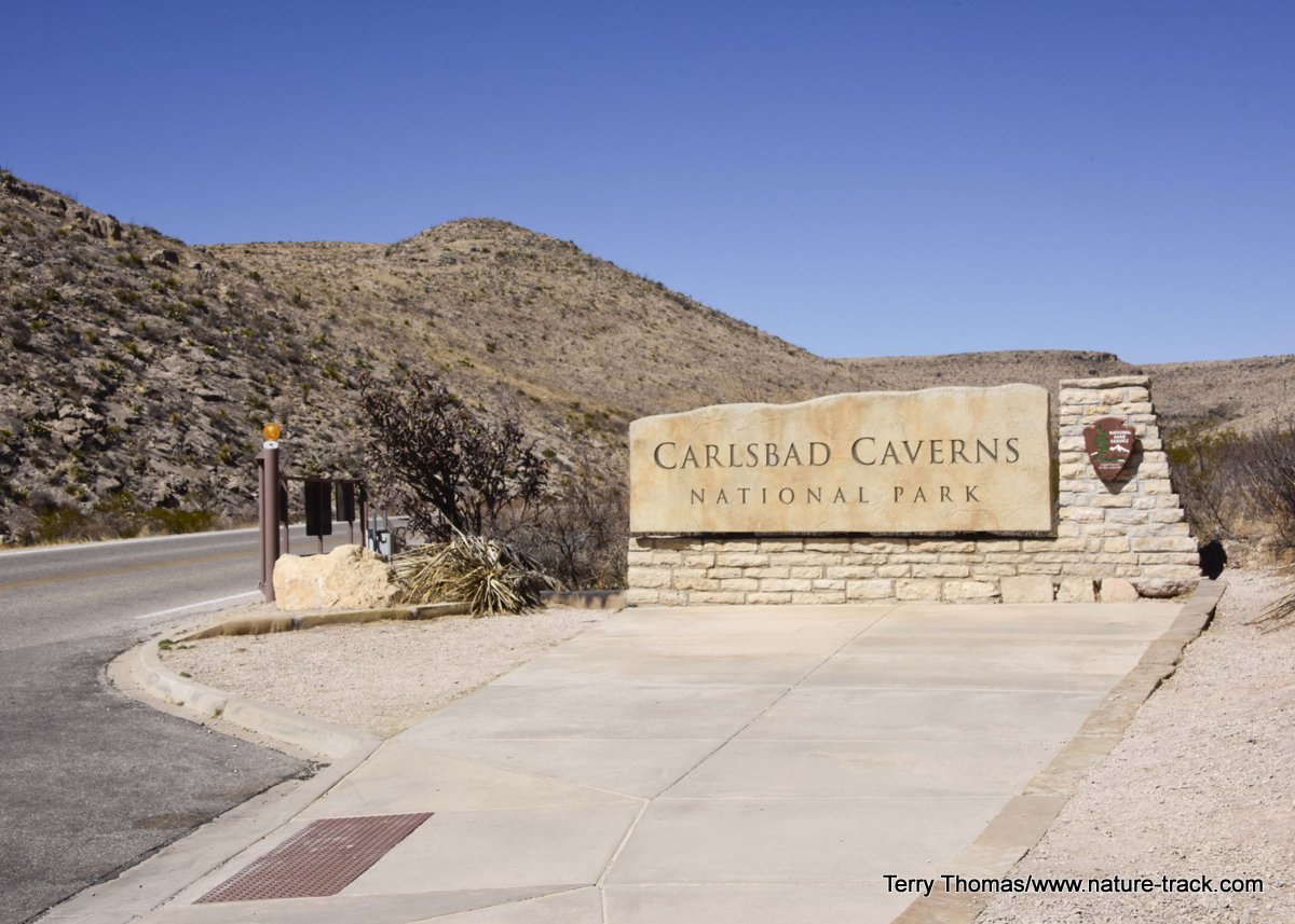
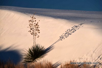
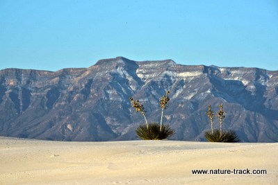
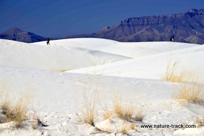
We visited Carlsbad Caverns and Guadalupe Mountains National Parks in March this year. These parks are specific parks. By that I mean that they showcase one thing. In Carlsbad, it is the awesome cavern/cave. In Guadalupe, it is hiking in the Chihuahuan desert wilderness. If you want to learn more about these parks, click on the image below.
February 28, 2022
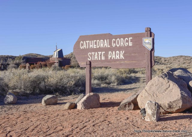
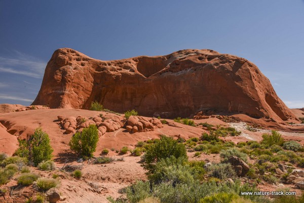
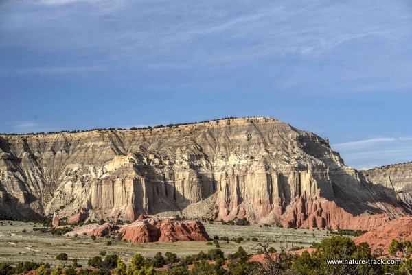
We visited Cathedral Gorge State Park in Nevada during mid-February this year. This is a fascinating place with some amazing geology. It is definitely worth a visit. Read all about the park and what to do and see by clicking on the image below.
March 1, 2020
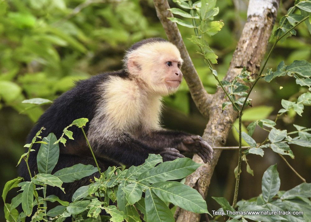
We just returned from a trip to Costa Rica. If you have a hankering to go to Costa Rica, perhaps our experiences can help you create the trip of a lifetime for you. Just click on the monkey below to read more.
October 30, 2019
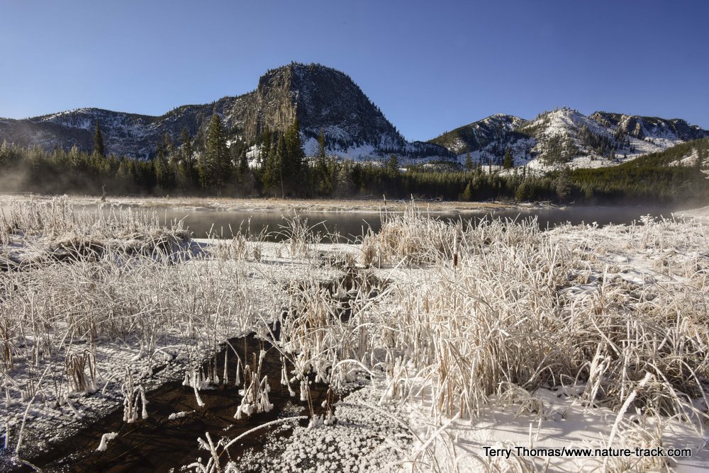
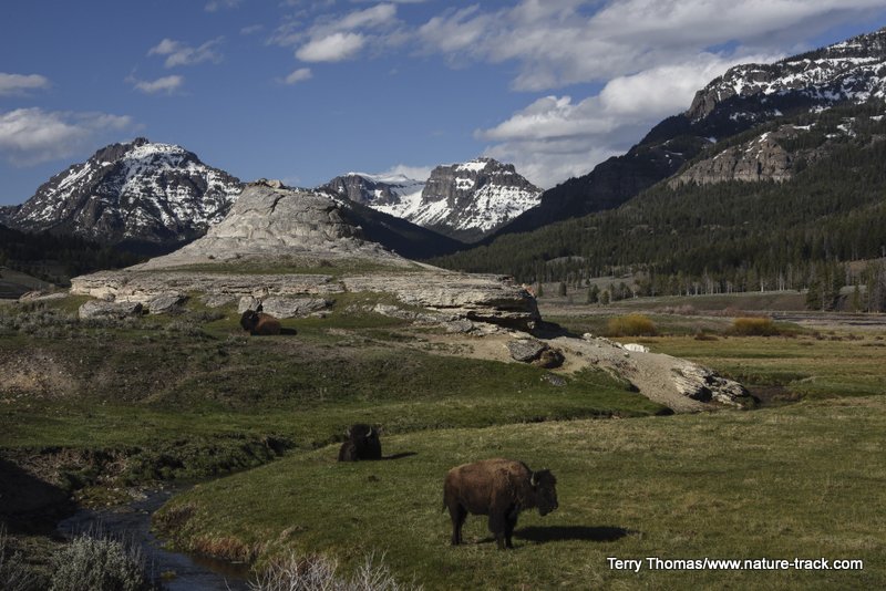
If you hope to get to Yellowstone one more time before winter sets in, you had better hurry! Read more by clicking on the image below.
The Fourth Annual Bucks for Birds Birdathon is coming up May 20th -May 27th. Find out more by clicking on the image below.
March 22, 2019
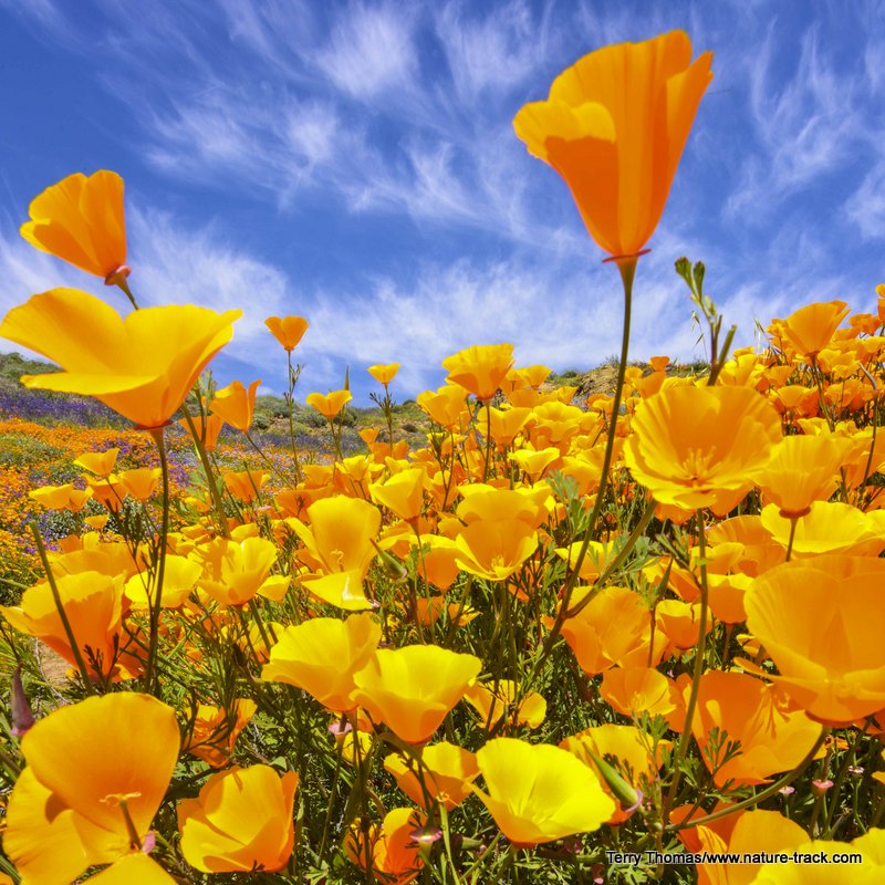
You have likely heard about the incredible poppy superbloom occurring right now at Lake Elsinore, California. We were there on March 19th and it truly was the show of a lifetime. Read more about it by clicking on the image below.
March 18, 2019
If you are interested in learning bird songs, I just posted a list of western birds organized by habitat that is a suggested starting list. Click on the image below to see the list.
March 11, 2019
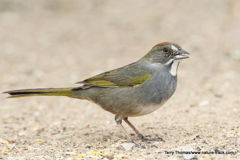
If you like to bird, and if you would like to get to know the southeast corner of Arizona, read about our visit there and the birding opportunities that abound. Just click on the image below.
January 28, 2019
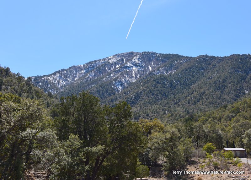
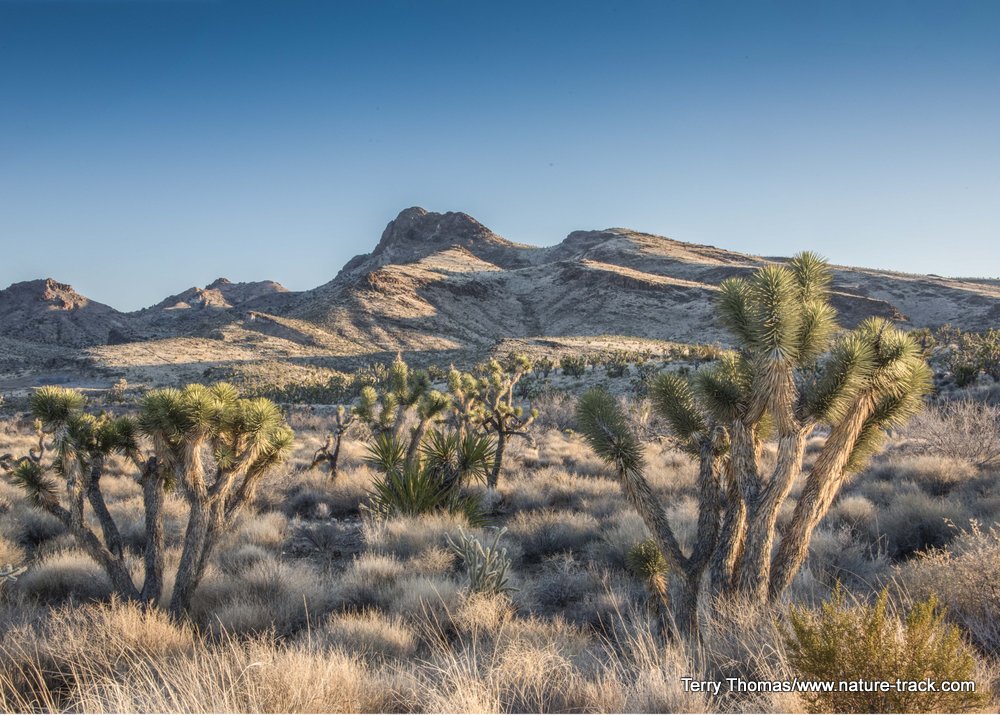
We visited a place in Southern California that is a far cry from places like Disneyland and Knott's Berry Farm. Mojave National Preserve is an incredible, diverse and wonderful place. Read about our visit there by clicking on the image below.
November 12, 2018
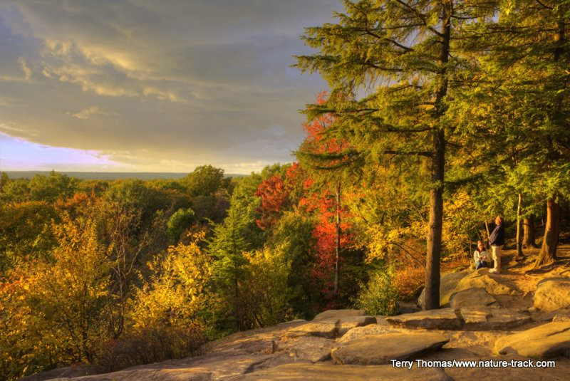
Have you ever heard of Cuyahoga Valley National Park? This is Ohio's only national park. It is a hiking/biking dream and full of beautiful scenery. To read more, click on the image below.
October 31, 2018.
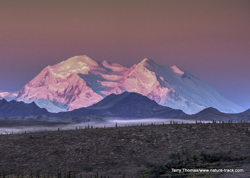
I have just completed a blog on our visit to Denali National Park at the first of September. This place should be on everyone's bucket list. Read more and learn why by clicking on the image below.
October 19, 2018
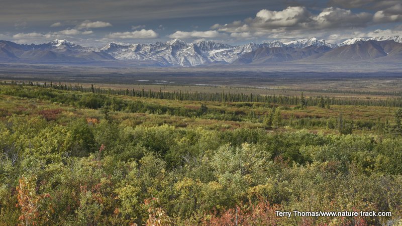
I just completed a blog on traveling the Denali Highway between Paxson and Cantwell Alaska. You may hear horror stories about traveling this road but we found it to be well worth the drive. Click on the image below to read more.
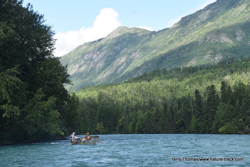
September 21, 2018
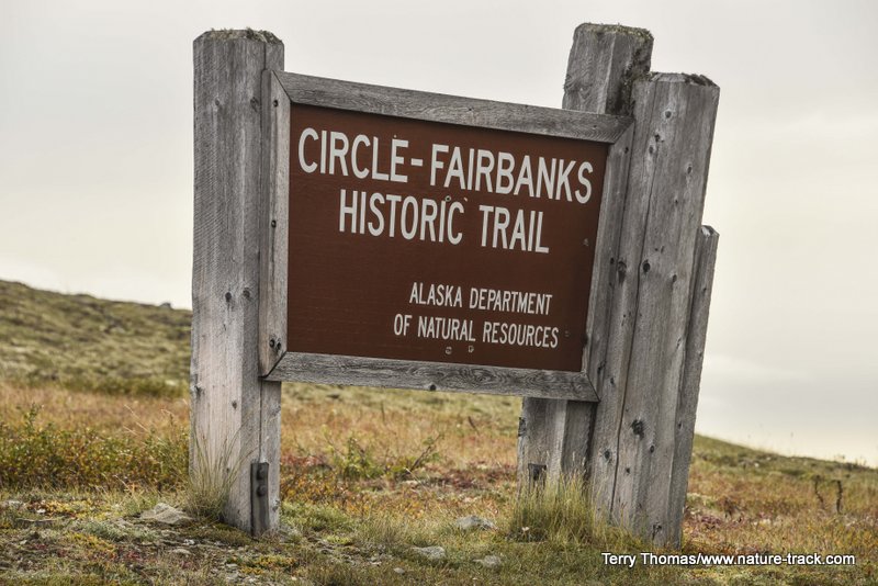
We are home from our great Alaskan adventure. I have just completed a blog on our visit to Fairbanks area. There was so much to do there (everything from northern lights to the Arctic Circle) this turned out to be a pretty long report. I hope you can wade through it. Might have to take it in stages! Just click on the image below.
September 8, 2018
After over a week without cell and internet (awesome!) in Denali National Park, we are finally back in service. I have posted a blog on what to do in Soldotna, Alaska. Check it out by clicking on the image below.
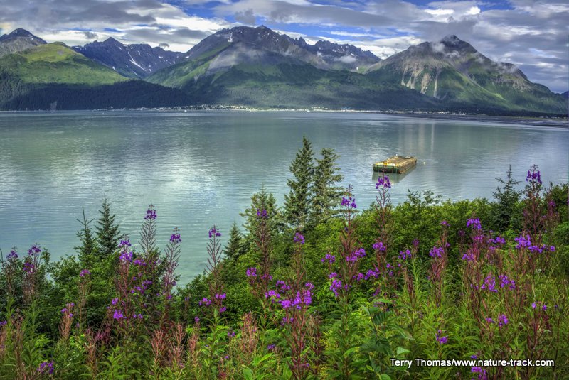
August 31, 2018.
Read the latest blog about our trip to Alaska and see what there is to do in Seward. Click on the image below for more.
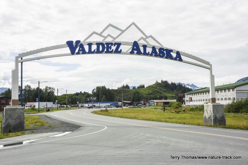
August 27, 2018
Read here to find out what to expect from a visit to Valdez, Alaska. Click on the image below.
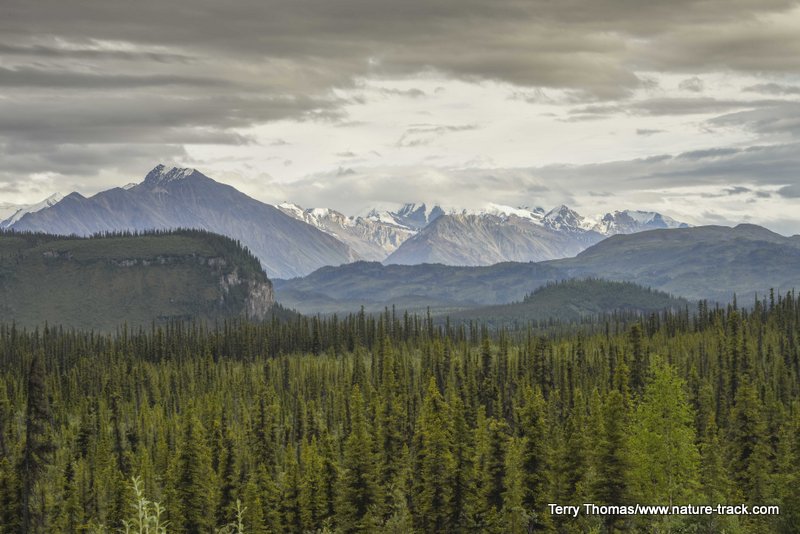
August 20, 2018
Read about what our largest national park, Wrangell-St. Elias, is like. You will want to go there! Click on the image below for more.
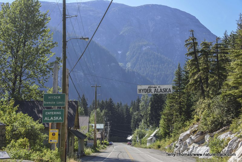
August 8, 2018
Find out whether or not Hyder, AK should be on your Alaska travel plans by clicking on the image below.
August 7, 2018
Jasper is the biggest of the four Canadian Rockies National Parks. Is it the best? Click on the image below to read our experiences there.
August 6, 2018
Avoid the crowds in the Canadian Rockies by visiting Yoho and Kootenay National Parks. Read about our experience by clicking on the image below.
August 2, 2018
Want to go to Banff National Park in the Canadian Rockies? Here is what to expect. Click on the image to read our blog.
May 10, 2018.
What is Yellowstone like in the early spring? Are there crowds? Can you get around? What about snow? Click on the image to the right to find out what we saw on May 8 and 9.
April 18, 2018
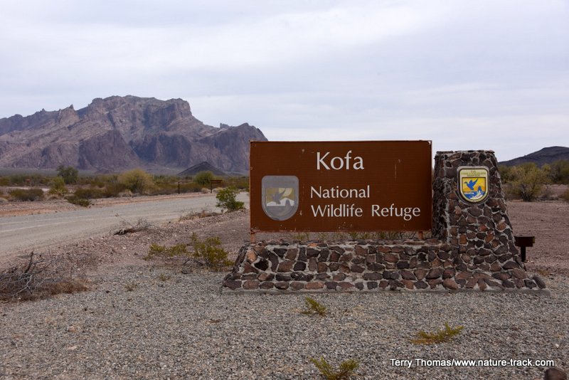
There is a good chance, a very good chance, that you have never heard of Kofa National Wildlife Refuge located between Quartzsite and Yuma Arizona. We were pleasantly surprised with the variety and beauty of this rugged section of the Sonoran Desert. Click on the image below to read more.
April 19, 2018
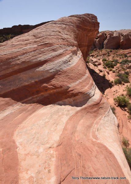
If you have never been to Valley of Fire State Park near Las Vegas, you should add it to your bucket list--the short one. Read more by clicking on the image.
April 14, 2018. Join in the Fun! The third annual Bucks for Birds Birdathon is scheduled for May 26-28 with a potluck celebration on June 9. This is fundraiser for Friends of Camas and Snake River Audubon Society. Both organizations strive to support birds and their environment and will split the net proceeds 50:50 to be used for environmental education, conservation, and scientific study. Click here for more information.
April 13, 2018.
About five weeks from now we will be celebrating migratory birds with the annual World Migratory Bird Day. Find out more here.
January 24, 2018
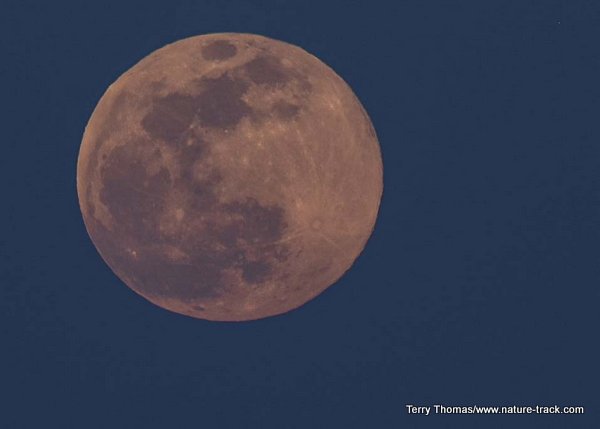
There is a lunar eclipse coming next week. Learn what to expect and when by clicking on the image below.
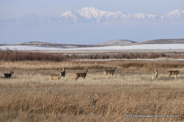
January 24, 2018
There were a lot of white-tailed deer, including many bucks with antlers, at Camas NWR near Hamer, Idaho, this morning. Click on the image below to read more.
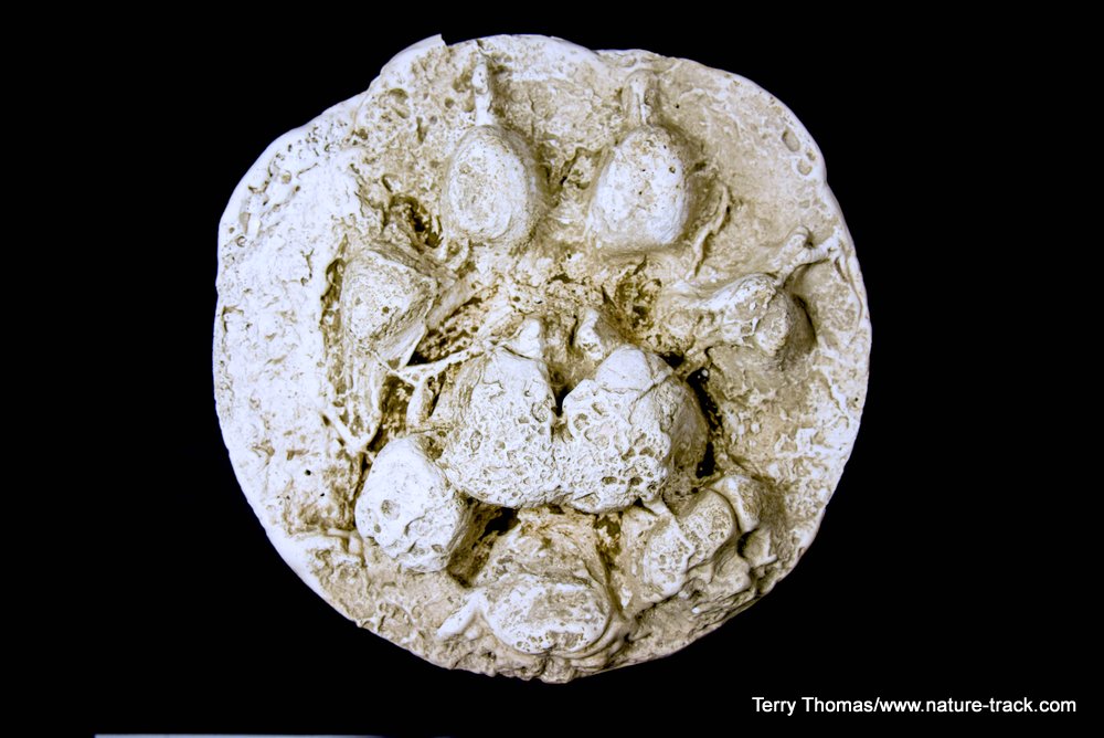
January 16, 2018
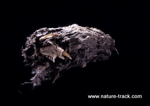
If you want to learn how to make plaster casts of tracks and other things, check out my video on how I made this cast of a wolf track I found in Grand Teton National Park. Just click on the image below.
I would love to hear what you think of this video. Use the Contact Us form or find me on Facebook.
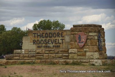
Theodore Roosevelt National Park in North Dakota is a great place to visit and is much less busy than the better known parks. Learn about the park by clicking the image below.
ALERT!!!!
Will you turn 62 before August 28, 2017? If so, you need to read this!
Fishermen are happy when pond 4 at Sand Creek WMA opens to fishing on July 1. They are even happier when they can launch non-motorized watercraft and really chase the big fish in that pond.
July 15, 2017
Today is the day that all waters on regional wildlife management areas (WMAs) open to boats. This includes Mud Lake, Market Lake and Sand Creek Ponds. These waters all have area closures to protect breeding birds such as ducks, swans, herons, ibises, gulls, soras, and more as they nest and raise their broods. Broods are nearly raised now and human disturbance is no longer a factor.
At Mud Lake the area west of what is known as the vegetation line is now open for exploration. Mud Lake is open to motorized boating.
At Market Lake, Marshes 1-4 are now open. There are several ramps for loading and unloading just across the main canal. Market Lake is open to non-motorized watercraft.
While fishing opened on July 1st at Sand Creek WMA ponds, all the ponds and Blue Creek Reservoir are now open for boats and float tubes. Like Market Lake, these are all non-motorized waters.
Deer Parks has a small area suitable for a canoe. It is called Butte Slough and the access is just south of the North Menan Butte trailhead on the west side of the road. It too is non-motorized.
As far as I am aware, there are no restrictions on Tex Creek WMA other than a non-motorized requirement.
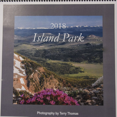
June 12, 2017
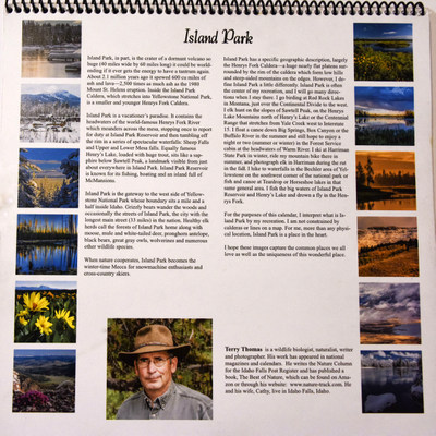
After a lot of work, my 2018 Island Park calendars are ready. I tried a test run in 2017 on the concept of a calendar unique to this area and it was well received. We have worked with a local printing company to produce the 2018 calendar and I am thrilled with the result. I think you will be too.
We all receive a lot of free calendars in the mail so why actually buy one? There are several good reasons. First, this isn't your garden variety calendar. it is a 12x12 inch format on heavy paper. It is printed not only in the USA, but in Idaho Falls. Also,there is nothing generic about this calendar. You will likely recognize some of the locations and others will hopefully surprise and thrill you. Finally, what better way to show off where you actually live and play than with calendars of our beautiful Island Park that you send to your family and friends. Go ahead, make them jealous!
I am working on lining up vendors in Island Park. The calendars are available at Elk Creek Station, Last Chance Store, Henry's Lake Station, Island Park Forest Service Office and Valley View RV Park. As I add other vendors, I will let you know where else you can find these calendars.
If you have a business and would like to add your logo to calendars to give to special clients, I can do that too.
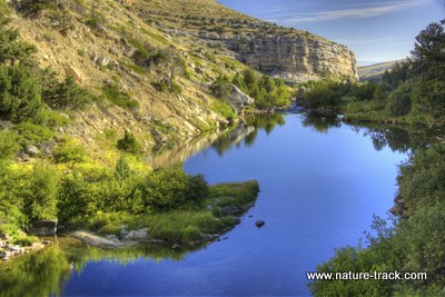
June 11, 2017
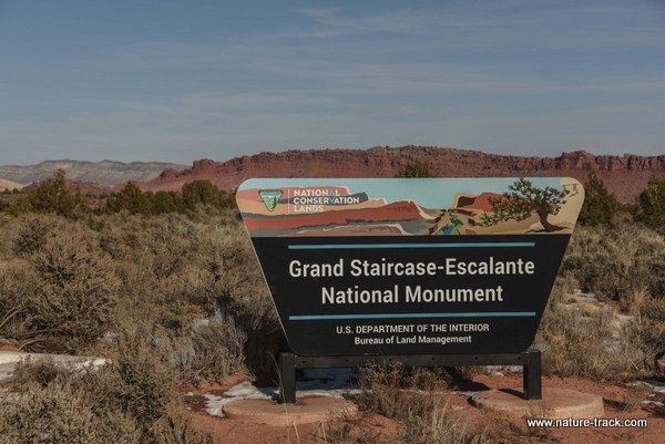
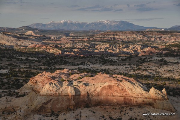
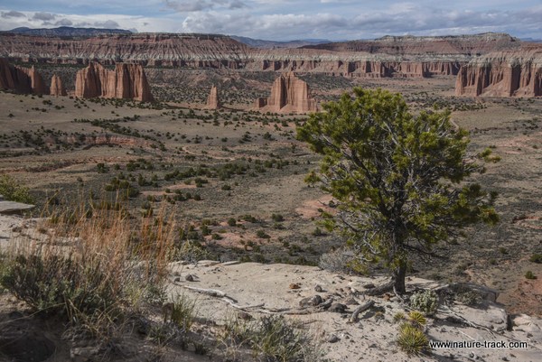
In late April and early May of 2017, we returned to southern Utah to continue to explore Grand Staircase-Escalante National Monument and Capitol Reef National Park. Check out our adventure by clicking on the images below.

Grand Staircase-Escalante National Monument 2017
Capitol Reef National Park 2017
March 13, 2017
Here are the opening dates for roads in Yellowstone National Park. Be ready to enjoy a new season in the world's first national park!
2017 Spring Road Opening Dates
• April 21: Mammoth to Old Faithful; Madison to West Entrance; Norris to Canyon.
• May 5: Canyon Junction to Lake; Lake to East Entrance (Sylvan Pass).
• May 12: Lake to West Thumb, West Thumb to Old Faithful (Craig Pass), and South Entrance to West Thumb; Tower Junction to Tower Fall.
• May 26: Tower Fall to Canyon Junction (Dunraven Pass)
• May 26: Beartooth Highway
2017 Construction
• Norris to Mammoth: expect 30-minute delays between Roaring Mountain and the Indian Creek Campground beginning April 21, 2017. From June 1 to September 10, this section of road will be closed during the night (10 pm to 7 am). From September 10 to October 6, this section of road will be closed to all traffic (day and night). Norris and Indian Creek campgrounds will remain open.
• Canyon Area: the Brink of Upper Falls and Inspiration Point are closed for the season.
February 9, 2017.
We just returned from 2 weeks in central and southern Florida. Below are five blogs about our experience. To start with, find out what traveling to Florida is like by clicking on the image below:
For West Florida click the image below.

For Venice Rookery and Myakka State Park Click on the image below
For Everglades and Big Cypress click below
For the Florida Keys and Dry Tortugas National Park click below

January 16, 2017
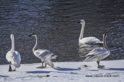
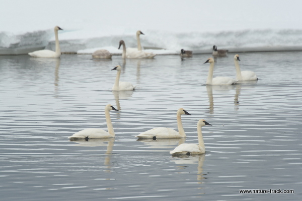
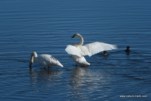
Want to know where to go to see trumpeter swans right now? Click on the image below to find out!
January 9, 2017
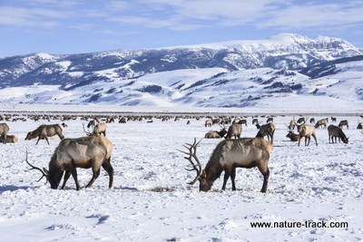
Find out how you can have a five species day (or more) with a big game winter road trip! Click on the image below for more.
November 2, 2016
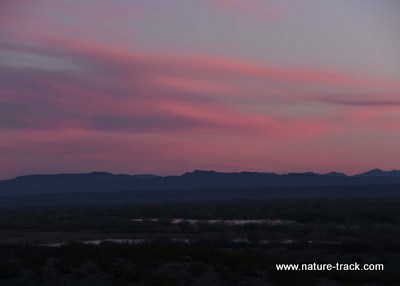
There are still several hundred sandhill cranes at Camas National Wildlife Refuge. They are hanging out in the farm fields just south of the headquarters. If you want to see them, you should hurry. They could head south any time.
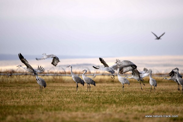
November 2, 2016
Interested in finding out more about Fossil Butte National Monument including where to go to find your own fossils? Click on the image below!

October 10, 2016
Click on the image below to find out more about what to do and where to go when you visit Badlands National Park in South Dakota.

October 9, 2016
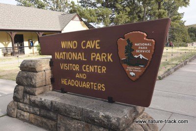
Click on the image below to read about Wind Cave National Park. It is more than just a hole in the ground.
October 9, 2016
Yesterday was awesome at Grand Teton National Park. Leaves are dropping fast in most areas but the mountains were frosted with new snow all the way to their bases and that was cool. We saw a pine marten on Signal Mountain and watched it catch a mouse. That was pretty cool too.
The Moose Wilson road is now back to normal. The signs proclaiming it a sensitive wildlife area and the subsequent orange cones that blocked all parking along the road are now gone.
The aspens along Palisades are still looking great and would be worth a trip. The cottonwoods along the South Fork still haven't peaked and that is my favorite time. I like it when there is still a little green that complements the yellow.
October 4, 2016
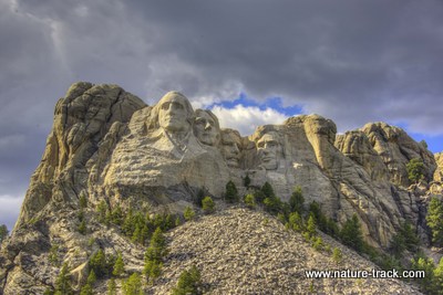
Click on the image below to read about our visit to Mount Rushmore including the nighttime lighting ceremony, something you should not miss when you visit.
October 4, 2016
Click on the image below to read about Custer State Park in South Dakota. It is a wonderful place to visit with lots of wildlife and terrific scenery.

October 1, 2016.
Click on the image below to read about Jewel Cave National Monument.

September 30, 2016
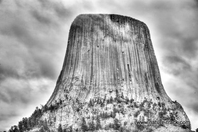
Here is the second post from our recent trip to Wyoming and South Dakota. Read more about Devils Tower National Monument by clicking on the image below.
September 26, 2016
Here is the first of half a dozen posts on our recent trip to South Dakota. Read about Sinks Canyon State Park near Lander, Wyoming here.
September 24, 2016
Just a quick heads up that the autumn colors in Grand Teton National Park haven't been this good in years. The cottonwoods along the river typically get hit by frost and turn brown in places or are shredded by wind. This year, as of Thursday, September 22nd, everything we could see from the highway was in full color with no brown. The same is true for the aspens and willows. Most are in full color and are putting on a sensational show.
Check back here in the next few days for posts on our recent trip to Wyoming and South Dakota. We'll have a play by play on what to expect, how to get there and where to stay. Posts will include: Sinks Canyon State Park in Lander, WY, Devils Tower National Monument, Jewel Cave National Monument, Wind Cave National Park, Custer State Park, Custer, SD, and Badlands National Park. I might even through in something about Mount Rushmore National Memorial.
August 17, 2016
Olympic National Park in a day? What were we thinking!?!?!?!? Read more here
August 11, 2016
What is Mt. Rainier National Park like in June? Read here to find out!
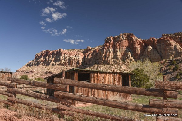
Capitol Reef National Park and Grand Staircase-Escalante National Monument
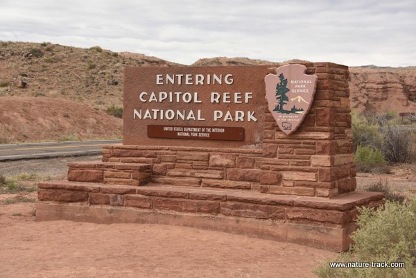
The best kept secret in Utah is undoubtedly Capitol Reef National Park. This park has everything the other parks do and I mean all of them combined. It is like a mix of Zion, Bryce, Canyonlands and Arches National Parks and on top of that has ample archeological sites such as petroglyphs and a strong pioneer history. In fact, the park still maintains orchards begun by pioneers in the 1880s and has over 2800 fruit trees in about a dozen orchards. In season, which runs from mid-June through August, you can eat as much fruit—cherries, apricots, apples, peaches, pears and even quince—as you want for free and carry away bushels full at a dollar a pound. What other national park allows you to do that? Utah has had a campaign to increase tourism throughout the state for the past several years and Capitol Reef NP has seen visitation grow by 20 percent each year but it is still only seeing a fraction of visitors the other parks see.
From Salt Lake City, it took four hours to get to Capitol Reef National Park in Southern Utah. Since we were towing a trailer and not doing Interstate speed anyway, we decided to stick to backroads as much as possible. So, at Nephi, we gassed up and headed toward Levan and Gunnison on Highway 28. We passed through Salina then up Highway 89 then we jumped on Highway 24 bypassing Fish Lake and on to Loa, Bicknell and Torrey, which is just 12 miles from the visitor center. We didn’t get to the Park until about 3 p.m. and the campground was full. It didn’t help that this was National Park Week where park entry was free, but the campground host said that the campground fills up by midafternoon most days in the spring. There are only 70 sites, some of which have full hookups, but 70 isn’t very many.
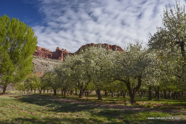
Apple trees in bloom at the campground.
We
pulled the trailer back toward Torrey and found a fine place to dry camp on BLM
ground just 0.4 miles outside the park boundary. There was room for 20 or more
campers, depending on how people parked. We had it to ourselves though most of
the time.
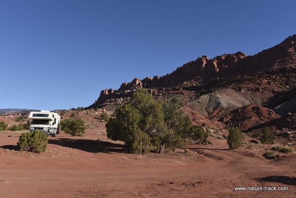
This camping area on BLM property was free and just outside the park, less than 8 miles from the visitor center.
We then went back to the park and started with a drive down the Scenic Drive, a 10 mile long dead end road. We took a hike in Capitol Gorge, a long narrow canyon with high vertical sides, and saw Native American petroglyphs and pioneer graffiti. On another day we went into Grand Wash to the trailhead but never made it on the trail because of an injury I will describe later. Grand Wash is a canyon similar to Capitol Gorge but gets so narrow in one spot you can reportedly touch both sides at once. It is also a hike you can do from the scenic drive or from Highway 24 which is kind of cool.
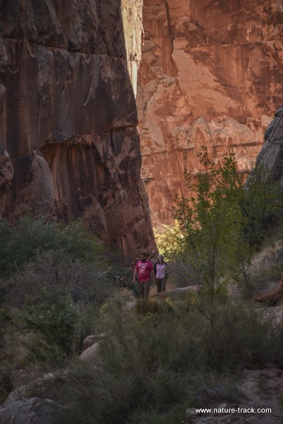
The hiking in Capitol Reef is awesome. This hike in Grand Wash accesses petroglyphs, pioneer registers and a section so narrow you can touch both sides at once.
On our second day, we took a mostly gravel road south along the 100 mile long Waterpocket Fold, one of the best examples of a monocline, or wrinkle in the Earth’s crust, in the nation. The road was actually very good, paved until we got past Notom, a tiny no-services burg in the middle of nowhere. Much of this drive is outside the park, but it still provides a good look at the fold and eventually reenters the park. We ate lunch at the Cedar Mesa Campground inside the park. This no-fee, first come, first served, campground has five sites and no services other than an outhouse and picnic tables at each site. There were only a couple of camps there. I don’t think I would try to bring my trailer there. The sites are small and I don’t think there is a way to turn around with a trailer.
After lunch, we took a side detour up the Burr Trail switchbacks. This was really a fun road and we had great views of the Henry Mountains. On top, we took a look at Peekaboo Arch and then headed toward the boundary of Capitol Reef with Grand Staircase-Escalante National Monument where the road turns back to pavement. Little did we know we would come back to that very spot from the other direction one week later.
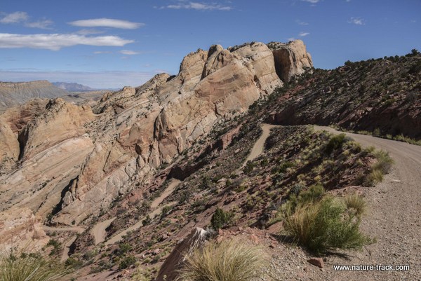
The Burr Trail switchbacks are certainly not suitable for trailers of any type. However, if the roads are dry, most cars could handle it with ease.
We then retraced our steps and headed out toward Halls Creek Overlook by turning right at Eggnog Junction. The overlook road is about half a mile down toward Bullfrog. To give you some perspective, the overlook is about 15 miles upstream from Hall Creek Bay on Lake Powell. This overview is a great place and there is a trail that drops into Hall Creek and heads to the Hall Creek Narrows about eight miles downstream. The road in though is quite rough and will require a high clearance rig. Also, if you are into photography, I think this would be a better morning shot than evening. The sun will be behind you in the morning putting color in the western sky if you are lucky and then lighting up the canyons on the west side.
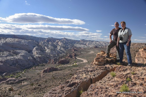
Hall Creek Overlook. This is a great place to be for morning light. This photograph was taken in afternoon light and it isn't bad either. The trails from here lead to some pretty cool places.
The next morning we went back down the scenic drive and on a whim decided to drive down Pleasant Creek the dirt road that continues past Capitol Gorge. About a mile down the road we found an old ranch, originally homesteaded by Ephraim Hanks and his family, some of which has been converted into an educational/research station. The old ranch stuff was really interesting and we found that Pleasant Creek is the trailhead for a trail that can take you all the way to Notom.
Pleasant Creek Ranch was started by Eph Hanks. Now it is a research center and trailhead.
After that, we packed up, and with a commitment to return in a week, we headed to Grand Staircase-Escalante National Monument. We had been the Paria Canyon side of the Monument in January and were so impressed that we decided that we needed to return and spend more time there.
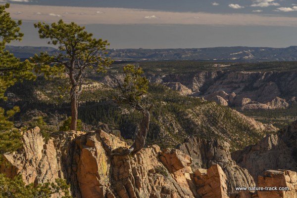
The drive over Boulder Mountain (part of the Aquarius Plateau) from Torrey to Boulder on the famous Highway 12 was awesome. I can imagine that driving that road in the middle of summer can be pretty frenetic with heavy traffic but our drive was great. There was still patchy snow up near the top but not as much as I expected.
The views from the Larb Overlook on Highway 12 between Boulder and Torrey are really stunning. I just wish the Forest Service (the Park Service too, for that matter) would do a better job managing the views by removing trees that block it. This is a pet peeve of mine.
From Boulder we headed to Calf Creek Recreation Area with hopes of finding a campsite. There are only 14 sites available though and once again we weren’t lucky. By the way, the sign says no rigs over 24 feet as turnaround space is limited. Our trailer is classified as a 24 footer but is about 28.5 feet long total. We were able to turn around but I don’t think a much larger rig could.
Calf Creek has a 3.2 mile hike up the creek to the Lower Calf Creek Falls. These falls are so beautiful and popular that we saw photos of them at just about every store, café and gas station we stopped at. The trailhead parking was also always overflowing. We made plans to come back and hike it when we had a full day later in the week, plans that were not to be as it turned out.
Calf Creek is a beautiful narrow canyon cut through the sandstone.
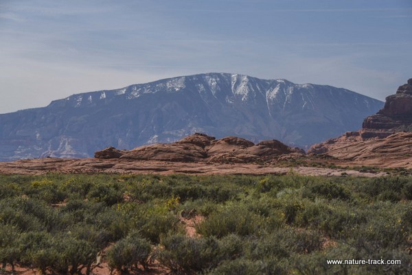
We found a campsite along the Spencer Flat road at MP 70, about four miles from Calf Creek. We dry camped there for six nights and only had neighbors twice. From our campsite we could see the Henry Mountains, Little Rocky Mountains and if we stepped about 50 feet from the trailer we could see Navajo Mountain far to the south.
As a note, you must have a free permit to dry camp anywhere in the Monument. You can pick up a permit at Escalante Visitor Center, Anasazi State Park, Kanab BLM and several other places. You might even find one at one of the trailheads. It is the same permit that is needed for backcountry camping. You fill it out, put the white copy in a trailhead box or deposit at a visitor center and tape the pink copy to your trailer. I picked up several blanks so I would be prepared next time.
This was one of the views from our campsite on Spencer Flat Road. Not bad for a free camping spot.
The next day we headed down the Hole-in-the-Rock road, about 55 miles of dirt that is really quite good for the first 40 miles. It gets progressively worse from there until the last several miles are pretty slow going. We stopped first at the Devil’s Garden, a small area on the west side of the road that has really really cool rock formations and arches. It is definitely worth a visit. I found the morning light to be great for photography but wish I could have seen it in the evening light as well. I think it would have been equally good and photography would have been a totally different experience.
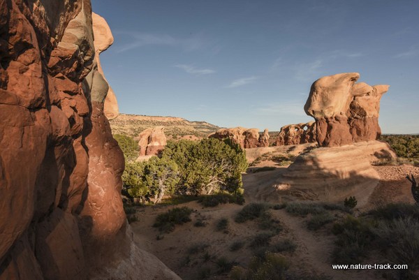
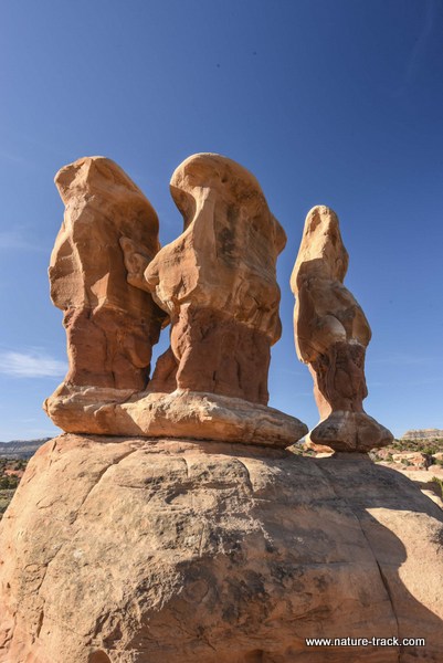
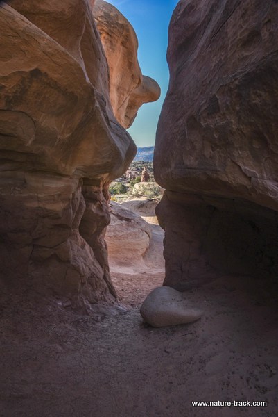
Devils Garden is a don't-miss location about 10 miles down the Hole-in-the-Rock Road.
We proceeded down the road and tried to find the dinosaur tracks but got on the wrong road. There is not a sign for the tracks so if you want to see them, get specific directions at the visitor center in Escalante before you go.
The road parallels Straight Cliff and 50 Mile Ridge all the way down on the west side. The east side is more open with several roads that go to trailheads for slot canyons such as Spooky Gulch, Dry Gulch, and Peek-a-Boo.
Our next significant stop though was at Dance Hall Rock, a place the first group of pioneers who braved the Hole-in-the-Rock waited for about three weeks for all their group to arrive. They would hold dances in the amphitheater of the rock.
I walked up there and enjoyed the ambiance, but on the walk back I stepped in a crack and severely sprained my ankle. After nearly passing out and puking from the pain, I hobbled back to the truck and removed shoe and sock. A tennis ball sized lump had already formed on my ankle bone. We immediately headed back to Escalante.
When we finally found cell service, we called our son, Ben, who is a podiatric surgeon in Salt Lake City for advice. We sent him some photos of the ankle and he had us perform a couple of tests that proved the ankle wasn’t broken. After more conversation we decided that the clinic wasn’t needed we just needed to follow RICE first aid—rest, ice, compression and elevation for 48 hours.
I was sure the trip was pretty much done but despite the swelling and obvious damage, I was able to walk on it more and more with each passing day. As I write this, almost two weeks later, the ankle still swells up after a full day, but it isn’t very painful. I try not to stress it too much and worry about another misstep but that is about it.
Dance Hall Rock was almost the end of our trip due to me tripping and tearing up my ankle. However, because of Cathy's wonderful nursing skills and great attitude and my son's advice, we were able to do almost everything we really wanted to do.
However, major hiking like to Calf Creek Falls was out of the question. Since we aborted the Hole-in-the-Rock trip the previous day, we decided that we could try that again. Hole-in-the-Rock truly is an amazing place. We could look down and see the waters of Lake Powell, once the Colorado River, and Navajo Mountain, on the Utah-Arizona border seemed almost close enough to touch. In fact, we had our best internet reception of the trip in the Hole-in-the-Rock parking lot because the towers are on Navajo Mountain.
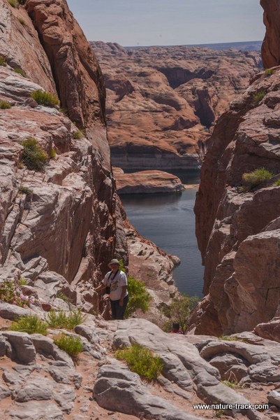
Cathy climbs out of Hole-in-the-Rock with the waters of Lake Powell in the background.
Navajo Mountain from Hole-in-the-Rock road. It was amazing to think that on January 1, 2016, we watched the sun rise over this same mountain, but from Bryce Canyon National Park.
After returning from Hole-in-the-Rock, we decided to use the rest of the day visiting two state parks: Petrified Forest at Escalante and Kodachrome Basin near Henrieville. Petrified Forest was pretty lame. I wasn’t able to do the longer hike that promised whole trees so we opted for the two dollar (literally) garden walk. I kid you not, the trail was a whopping 100 feet long with chunks of petrified wood placed around. The campground was nice and there is a fishable lake there but all in all it wasn’t impressive.
Kodachrome Basin was much nicer and worth a trip. It is pretty much as small version of Capitol Reef or some of the other parks. We took a short hike up to Shakespeare Arch, the only arch in the park. It was worth the walk. The campground here is nice too. One thing about Utah state park campgrounds though—all sites are reservable and your chances of just happening on to an open campsite are almost nil. Make reservations if you want to camp.
Kodachrome Basin is a state park and is worth the visit.
Shakespeare Arch in Kodachrome Basin. It is a short and worthwhile hike.
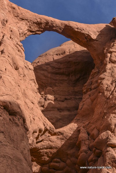
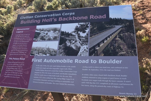
On our drive to Kodachrome Basin, we noticed a road named, Hell’s Backbone. It takes off from Escalante, cuts over a high mountain pass adjacent to the Box-Death Hollow Wilderness and ends up almost at Boulder. It takes several hours to complete but the road wasn’t bad. We did cross one bridge up on Hell’s Backbone proper that was originally built by the CCC in the 1930s. At one time, this road was the main road between Escalante and Boulder. You get some pretty terrific scenic views from up on top and it is worth the time if you are in the area. I am sure that during the summer it is much busier, but we only saw half a dozen other vehicles.
Box-Death Hollow Wilderness from the top of Hell's Backbone.
We got a late start on Saturday when we decided to go down the Burr Trail on the east side of Boulder. This trail was built by John Atlantic Burr to move cattle from Boulder Mountain to Bullfrog Basin in the 1880s. Now it is a paved road in the heart of the Grand Staircase-Escalante NM. It was an incredible drive too. Long Canyon is just as beautiful as Zion National Park. You cross or follow several creeks with broad green riparian zones that complement the red rock of the vertical canyon walls. At MP 11.2 there is a pullout and a short slot canyon on the west side. I really didn’t define this canyon as a slot canyon because for me, a slot canyon was formed by erosion. This one seemed to be formed by a cracking of the wall. It was still pretty cool though. Long Canyon has one campground with about 7 units. It is at Deer Creek and is First come first served. Also, it is not suitable for trailers of ANY kind as there is no turnaround. There are several nice places where you can pull off the road and dry camp though, even with larger trailers.
While on that subject, trailers are not recommended on the Burr Trail at all but I can’t see why. They warn of switchbacks and granted, the switchbacks would not be negotiated with a trailer, but they are about 30 miles away. There is a lot of ground and some good camping along the way. I wouldn’t hesitate to take my trailer up there.
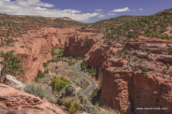
Driving up Long Canyon on the Burr Trail is like driving through Zion's National Park. It is that awesome.
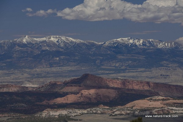
The overlook at the top of the canyon opens to stunning views of Waterpocket Fold and the Henry Mountains. The wind was pretty stiff up there and that made photography a real challenge. I determined that I needed to be there for sunrise on Monday morning which I did. We decided to follow the Burr Trail until we came to the border with Capitol Reef NP at the top of the switchbacks where we had been earlier in the week. It was pretty fun to make that full loop.

Scenes from the overlook at the top of Long Canyon, looking east to the Henry Mountains and toward the Waterpocket Fold.
The changing weather that had been predicted for several days finally caught up to us on the day we determined to move camp back to Capitol Reef. It snowed and rained and rained some more much of the afternoon and following morning when we moved. I was nervous about going back over Boulder Mountain, but besides a few miles of slushy roads on top, it really wasn’t anything to worry about.
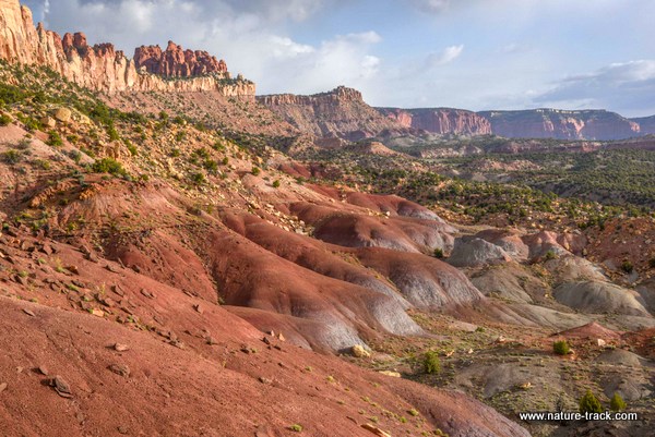
We got to Fruita (where the visitor center is at Capitol Reef) about 1100 and found a campsite in the campground. The campground did fill by about 2 p.m. but there were 22 sites to choose from when we pulled in. Camping costs $20/night and $28/night if you want hookups. There are flush toilet facilities but no showers. There is also a trailer dump station, free to campers but costs $5 if you camp elsewhere. You can also fill up on fresh water there for free.
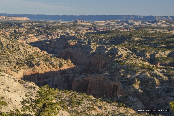
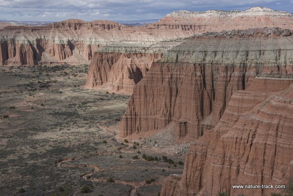
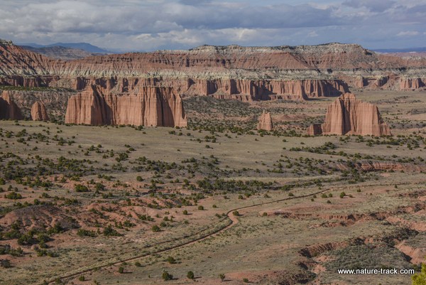
The weather had cleared somewhat although there was a possibility of rain throughout the day but we decided to risk it and take the drive through Cathedral Valley in the north section of the park. This is a 70 mile long gravel road with one river ford on the Hartnet Road (the south end of the loop). The ranger recommended that we start there instead of Caineville Wash so we could see what the river crossing was like. It would be pretty inconvenient to drive all the way around the other way just to find that we couldn’t negotiate the river crossing and have to retrace our steps for 70 miles. It turned out that for any vehicle with high clearance, the river crossing was no big deal. Water was about a foot deep and that is what we were told to expect unless there was a sudden storm. Also, at the visitor center you need to buy the $2.00 newspaper that describes 26 things you will see along the trip. It is well worth the money.
Cathedral Valley is awesome. Coming in on the south or Hartnet road, you will first come to some bentonite hills. This hills are in grays and reds and quite pretty. However, the road also gets extremely greasey with just a little rain. We had to put the truck in four wheel drive when a sudden shower caught us right in the middle of that area.
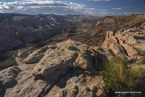
From there, drive down the short turn off toward the overlook into the South Desert. There are two different overlooks, one on each end. The first or southern one is pretty neat but the second one is spectacular.
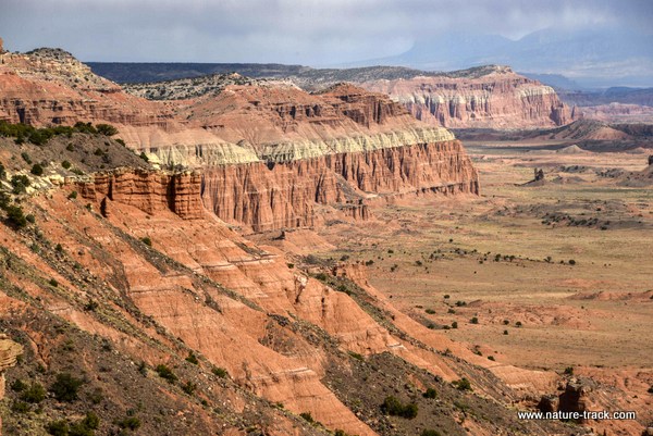
The view from what I would call the north overlook into the South Desert. This overlook is closer to the campground.
Next you will come to the Cathedral Valley campground. It has half a dozen sites with an outhouse and picnic tables. No one was camped there when we were there. It is first come first served and open all year if you can get there.
The views from Cathedral Valley overlook and through the valley itself are nothing short of stunning. It matches anything in the bigger name parks. I don’t think I will elaborate more. You can see the photographs and judge for yourself.
There is a pretty neat sinkhole on the far end of the valley. Just follow the signs and you will find it.
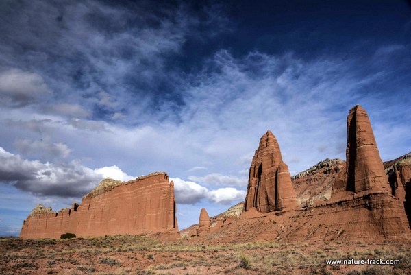
The last stop inside the Park is the Temples of the Sun, Moon and Stars and the glass mound. These are well worth stopping at. If you are photographing, the glass mound, a small mound about 12 feet high and made of selenite crystals, photographs best in early morning or late evening light. Otherwise, use flash to bring out the crystals. We were at this area just as the last rays of the sun were lighting up the temples. It was pretty spectacular but I wished I could come back in early morning light.
The drive out through Caineville Wash was
actually very interesting even though is was pretty dark. I am confident I could spend several days wandering
in that country and filling a couple of memory cards in the process. It isn’t
part of the park but it is worthwhile. It is a place I want to return to.
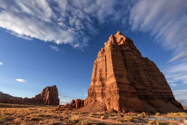
Temple of the Moon.
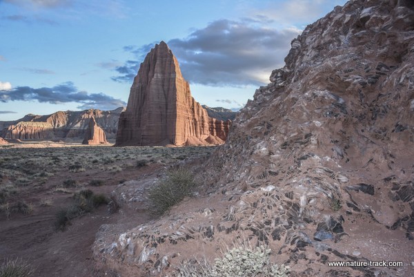
Glass Mound with Temple of the Sun (large) and Temple of the Moon (furthest back).
The next day was threatening rain and we wanted to do one short hike. My ankle wasn’t really holding me back so we decided to check out Hickman Bridge, a large natural bridge whose trailhead is only a few miles downstream from Fruita.
It is clearly one of the most popular hikes in the park and we saw lots of people. And that was one of the best parts. We stopped and visited with Paul from New York, the Carey family from Connecticut and Vicky and Warren from Alaska. Each had a fascinating story. The bridge was certainly worth the 1.2 mile hike in and of itself. For me it seemed to photograph best from down in the creekbed area. I just wish I would have had a blue sky background.
Talking to people on the trails is always a highlight. Here we met Paul, the Carey family and Warren and Vicky.
Hickman Bridge. I would have paid a lot for a real blue sky with some fluffy white clouds!
The rain started just about the time we got off the trail and it rained, on and off, for the rest of the night. It was snowing when we left Torrey for home but the roads were clear. I guess it shouldn’t surprise me that it was snowing again in Torrey. Torrey is at about 6,200 feet above sea level, much higher than Idaho Falls.
All in all, it was a great trip, one worthy of repeating and spending even more time. I hope to return in the summer or fall as well to see it in a different season and perhaps hike the slot canyons this time.
See you after our next adventure!
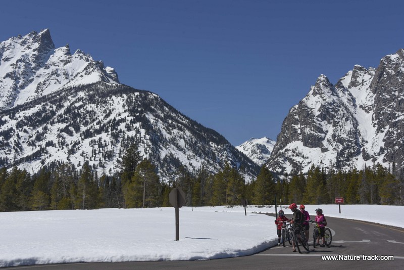
Biking in Grand Teton
April 11, 2016
Cathy and I headed over to Grand Teton National Park last Friday (April 8) to ride our bicycles on the inner park road now that it is plowed. We found that all the park roads have been plowed out and there is between a foot and two feet of snow on the ground depending on where you are. Even the Moose/Wilson road is plowed and can be traveled by bicycle. There is only about a three mile stretch that isn't open to vehicles as the road it plowed from the north to Death Canyon and up from the south end to Granite Canyon trailhead. This road should open to vehicle traffic on May 1.
At this point the parking on the inner road is at the Taggart/Bradley Lake trailhead. If you park down by the Visitor Center, you will have to ride on the road with the traffic until you hit the gate at Taggart/Bradley.
Although we went on a Friday, the parking lot and the west side of the road were already filled up by noon. When we left on our bikes only one vehicle was parked on the east side but when we came back, there was a quarter mile of parked vehicles on that side as well. Don't expect to find solitude although it was less busy than expected with all those vehicles.
We rode up to the String Lake Scenic Loop and then back along Jenny Lake (round trip of almost 13 miles). From gate to gate (the north gate is at Signal Mountain Lodge) it is 12.5 miles one way. It was a wonderful ride with great views of the Tetons, white against the blue sky. It was a great day and I encourage you to try it.
You will likely want to go in the afternoon as the mornings are still in the 30's.
As a side trip, we went to Miller Butte on the Elk Refuge. There are still about 50 bighorn sheep on the hill but all were right at the crest this time. There are still a lot of elk on the refuge but we also found about 300 on the Antelope Flat Road near the Teton Science School.
Roads begin to open for the season
April 4, 2016
You can tell that spring is truly arriving when roads or areas closed for the winter to protect wildlife or conserve resources begin to re-open.
Here is a partial list of roads and areas that are open or opening in the next several weeks.
Grand Teton Park:
Antelope Flat Road in Grand Teton Park is now open. This road accesses Mormon Row.
The inner Teton Park Road has been plowed and is open to bicycles. It will open to vehicles May 1. Moose/Wilson Road will also open by May 1, possibly sooner.
The bicycle trail from Jackson to the Gros Ventre Road opens on May 1 as well. It is already open from Gros Ventre road north but it is NOT snow free.
Yellowstone:
Over the snow travel season is over for the year.
2016 Spring Road Opening Dates
- April 15: Mammoth to Old Faithful; Madison to West Entrance; Norris to Canyon.
- May 6: Canyon Junction to Lake; Lake to East Entrance (Sylvan Pass).
- May 13: Lake to West Thumb, West Thumb to Old Faithful (Craig Pass), and South Entrance to West Thumb; Tower Junction to Tower Fall.
- May 27: Tower Fall to Canyon Junction (Dunraven Pass); Beartooth Highway
Sand Creek Desert
The area between Highway 33 and the Egin/Hamer Road opened to human entry on April 1.
The area north of the Egin/Hamer Road will open May 1.
Note that the active dunes are not closed.
Idaho Department of Fish and Game:
Tex Creek Wildlife Management Area roads will open on April 15.
Sand Creek WMA is open east of the Sand Creek Road. West of the Sand Creek Road opens with the May 1 opening of the Sand Creek Desert.
BLM:
Heise/Stinking Springs winter range closure ends May 1.
The road to the top of Big Southern Butte will open sometime in May, when conditions allow.
Kelly Island Campground on the South Fork will reopen just prior to Memorial Day weekend.
Forest Service:
The South Fork Snake River Road (FS #206) above Heise, from Table Rock upriver to Black’s Canyon opens when the Ranger of the Palisades District decides road conditions warrant it and switches to the summer travel plan. This is usually between April 15 and May 1. For additional information, contact the Palisades Ranger District at 523-1412, or the Eastern Idaho Visitor Information Center at 523-3278
Note that there still may be closed roads on the Caribou-Targhee after the districts switch to the summer travel plans. Snow drifts, mud and other conditions may require some roads to remain closed for an extended period of time.
March 4, 2016
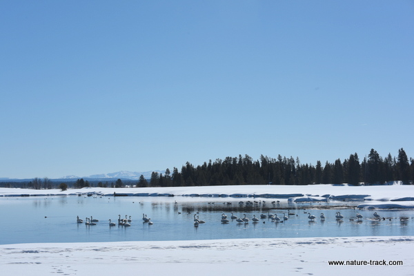
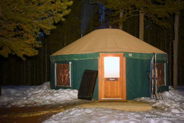
After having spent last weekend in Yuma, Arizona with temperatures in the high 80's, it was a bit hard to come back to East Idaho where 50 degrees is considered a heat wave this time of year. To top it off, we had scheduled an overnight stay in Harriman State Park's Cygnet Yurt. I wasn't sure I could handle the dramatic change!
However, temperatures at Harriman were moderate, dipping only down to about 19 degrees and climbing quickly today to almost 40 with no wind and a brilliant sun.
We have seen the Railroad Ranch many times so this time we decided to stay along the Henrys Fork trail and look for wildlife. We saw plenty, all in the form of water birds. About 100 trumpeter swans were king but there were Canada geese, mallards, pintails, blue-winged teal, buffleheads, Barrows and common goldeneyes, gulls and some we just couldn't identify at a distance. It was great wildlife viewing and the birds seemed much more tolerant of our presence than at other places.
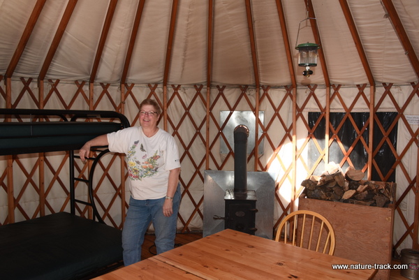
If you are wondering what a yurt is, here is a description from the Idaho Parks and Recreation website: Idaho state park yurts are circular, Mongolian-style domed tents. Every park yurt is about 20 feet in diameter with a plywood floor, canvas and hardwood sidewalls and a skylight. Each yurt can sleep up to five or six people and is built to withstand high winds, snow loads and summer heat. With lockable wood doors, windows with screens and storm flaps Idaho State Park yurts are a comfortable, peaceful and safe place to be, even in winter! Some parks allow pets in yurts, but please check with the park first.
Here are the particulars about renting a yurt. First, they are pretty popular so you had best plan well in advance. You can reserve a yurt by calling 888-922-6743 or visiting the IPR website and following the link to the registration website that is in the right hand corner of the Harriman page.
A yurt costs $55/night a $20 increase from just a couple of years ago. That seemed a bit steep to me given that there is no electricity, no running water, propane is NOT provided for the lantern and cook stove that are provided and you have to use a vault toilet. You also must refill the wood bin yourself and clean the place. I am not sure what the Park staff actually do for the $55. I suppose it is a case of location, location, location. However, since a yurt will sleep six, you can share the cost with another couple or two and then it is pretty reasonable.
Another frustration is that you cannot check in until 3 p.m. and must check out by noon. Given that there isn't really anything for Park employees to do other than check to see that the floor is swept and the previous occupants filled the wood bin, I think the 3 p.m. thing is a bit unreasonable.
I must say that the wood stove inside the yurt worked famously, and could have driven us out if we hadn't damped it. We were very comfortable all night, except for the obligatory middle of the night excursion to the bathroom which in this case was about 50 yards away.
However, it was still a fun experience, and I will consider doing it again. Yurts are available all year long but I would only be interested in the winter months when my camp trailer can't be used.
February 17, 2016
In response to my column last week about starlings, reader Donna Whitham whom I have known for years, wrote to tell me that a bottom suet feeder thwarts starlings but allows woodpeckers, chickadees and nuthatches full access. I asked her to send me a photo that I could share with others and she promptly did so.
Thanks Donna, I am looking forward to trying this out as soon as I can.
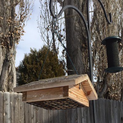
Photo courtesy of Donna Whitham.
In answer to my question in last week's newspaper column about how to keep magpies and starlings away from my homemade suet, reader Bob Cherry contacted me through this website with the following excellent advice:
January 21, 2016
Terry:
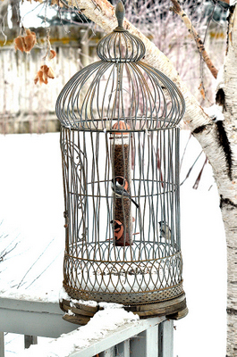
To keep magpies from eating all the suet and dry mealworms we put out for flickers and chickadees, we've used a "cage-in-a-cage" system, the suet cage commercially available (to stop squirrels)and the other homemade using a large decorative cage as the external barrier. Juncos have since learned they can feed off the bottom of the mealworm cage. I can send photos if you have a email address.
Bob
As follow-up to my questions Bob emailed the following:
Terry:
The suet cage is a commercial product that I believe we got from Dr Foster’s pet supplies. You can see that the internal cage holds two blocks of suet, while the outer cage prevents squirrels and magpies from getting to the suet. Smaller birds can pass through the outer cage to get directly to the suet. Flickers and, to a lesser extent, magpies have a long enough beak to reach the suet from the external cage. A downy woodpecker is able to stick his head through the outer cage up to his shoulders and that is enough to reach the suet.
The mealworm feeder is a standard thistle seed feeder that we initially just had hanging from a tree limb. The magpies wanted to eat the worms but could not fit onto the small perches. They solved that problem by flying straight at the feeder, putting their feet up in front of them, and bouncing hard off the feeder, setting it swinging. This knocked the dried worms out of the dispensing cups so the magpies could find and eat them on the ground below. Two would wait there while a third one did the work above. To prevent this, we hung the thistle/worm feeder inside a large ornamental bird cage. We bent the wires of the outer cage a bit to make somewhat larger openings to encourage birds to enter. You can see two chickadees demonstrating that they know how this system works. Juncos have learned about the spilled worms on the bottom of the cage and will also enter the large cage to forage for them.
You are welcome to use these photos and explanations in your newspaper column or your web site, but I would appreciate being credited.
Bob Cherry
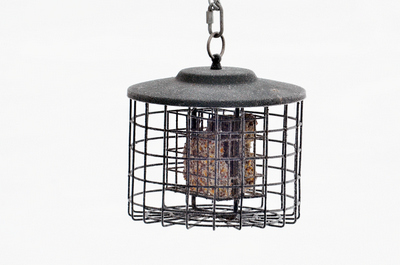
I knew there would be someone out there with a clever answer to what I am sure is a common dilemma. Thanks Bob, I really appreciate the feedback and am actively looking for a used birdcage now.
January 22, 2016
Final Notes
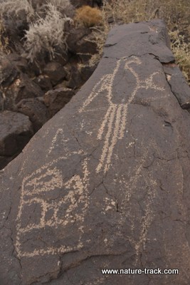
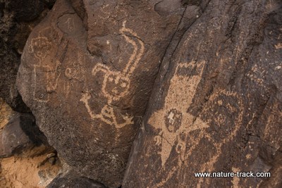
If there is a metaphor to describe our three week trip it would be a rock skipping across a lake. It seems like we barely touch down somewhere and then we are off to the next destination, touching base with as many cool things as we can enroute but never staying long. When we left Bernardo WMA, we passed by three national monuments that were too far off the beaten path, spent about an hour at Petroglyphs National Monument and drove through another stopping only long enough to photograph the sign.
It is a great way to get acquainted with places you want to spend more time in, but it is frustrating too, to not even be able to catch the spirit of a place.
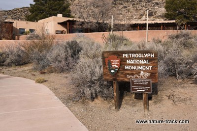
That is how it was with Petroglyph National Monument, literally in the suburbs of Albuquerque, New Mexico. We had about an hour to explore one trail and see the petroglyphs left long ago by Native Americans. The brochure says it is culturally insensitive to try and interpret what the images mean, so I won't do that here.
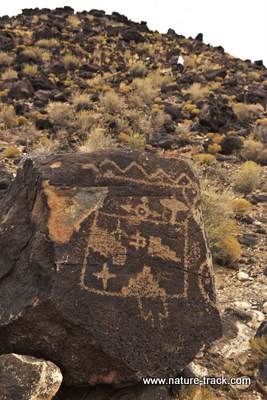
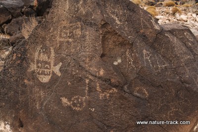
This bottom photo shows that even priceless historical treasures are not beyond the grip of vandals. There were several examples of this on the short trail we walked.
Suffice it to say that Petroglyph National Monument is a place where I could spend much more time pondering the past and even the future. Above you can see a few of the many thousands of petroglyphs preserved in this monument and you might feel the same way.
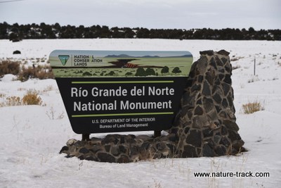
We drove through one more national monument on our way to Colorado Springs. Created in 2013, it is one of the most recently designated monuments. Like many of this type, it is actually administered by the BLM. Someday I would like to go back and discover what makes it special enough to have monument designation because from the highway we couldn't see much.
On our penultimate skip, we arrived at our daughter’s house in Peyton, Colorado, just east of Colorado Springs on Saturday and after taking it easy on Sunday, bounced to the top of a very chilly Pike’s Peak (14,110 feet asl). The views from there were absolutely stunning and I wish I could have tolerated more than a minute or two outside the car.
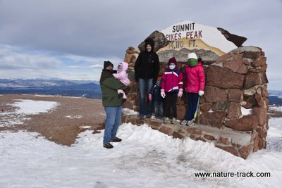
Getting to the top of Pike's Peak is no easy matter, even in a car. You first must pay the city of Colorado Springs a fee at the entrance gate, then drive up 19 very windy and very steep miles. If conditions are bad, you may be stopped at or before mile 12. If you choose to hike, it is 14 miles up.
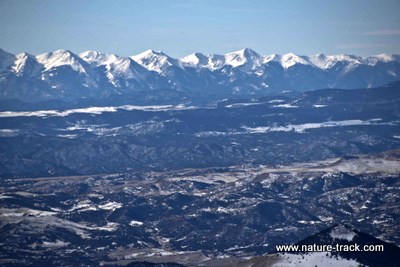
The 360 degree views from the top of Pike's Peak, such as this one of the Sangre de Cristo Mountains, are worth the trip. In our case though, it was too cccccold to bbbbbbeeee able to get a really quality photo.
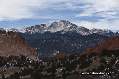
Pike's Peak seen through the Garden of the Gods.
We also visited the Garden of the Gods, a unique group of rock formations at the base of Pike's Peak. It was much warmer there and we walked the paved path through the "garden" and enjoyed the chance to get out of the car.
The drive home to Idaho Falls was a good reminder about being prepared for winter travel. I-80 was closed for about 6 hours from Laramie to Rock Springs while crews cleared the road and the wind subsided (a little). Roads were slick and patchy and wind gusts really buffeted the truck at times. Regardless, it was mostly beautiful and we didn't actually ever get snowed on.
January 22, 2015
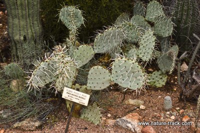
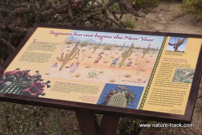
Saguaro National Park
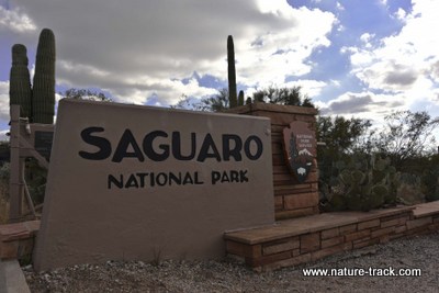
We are finally back in a very snowy Idaho Falls but I promised a blog on Saguaro National Park so here it is.
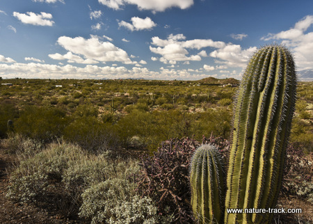
This wasn't our first visit to Saguaro National Park. It is a pretty neat place and we were looking forward to seeing the forest of giant cactus.
Saguaro National Park is divided into two totally distinct segments. One is east of Tucson and the other is west of Tucson, both about the same distance from downtown. Each segment has a visitor center and each has a driving loop that introduces you to the desert ecosystem. I really didn't have a favorite, both were worth the trip, but I did like the fact that the Sonoran Desert Museum mentioned in an earlier post is at the West District. I liked the drive loop on the East District a little better. Both segments have lots of trails and backcountry campsites. Both also have a couple of interpretive trails with the usual awesome signs that explain what you are or should be seeing.
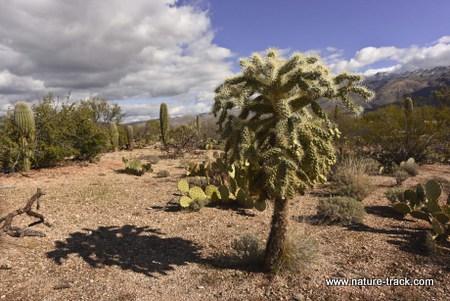
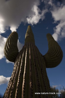
The Sonoran Desert is the exclusive home of the saguaro cactus. It is a wonderfully interesting place to wander through, with lots of diversity, although it seems that most of the plants can stick or poke you in some way. It is also interesting to note the juxtaposition of the desert and the snow-covered peaks that stand above Tucson. I did not remember that part and was a bit surprised by it.
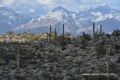
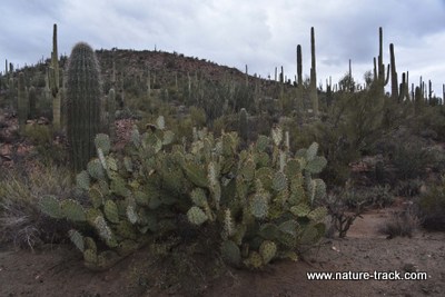
Another thing that we noted is that the suburbs of Tucson run right up to the borders of the park in some places. There is very little buffering of the park boundary by other public land. If you have enough money, you can have the park for your backyard.
Just above the middle of this photo you can see the edge of suburbia built along the park boundary.
Being so close to Tucson, Saguaro is a popular place. It is still worth a visit though and if you are ever in the area, you should stop by and spend a day or two.
January 16, 2016
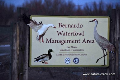
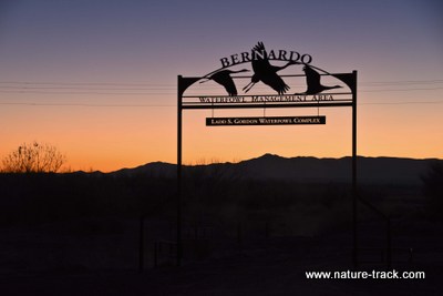
Bernardo Wildlife Management Area
After our short excursion to White Sands National Monument, we decided to spend several days getting reacquainted with Bosque Del Apache National Wildlife Refuge. We have been there twice before and each time thoroughly enjoyed it. We pulled in around 2 p.m. with expectations bordering on the sensational. A quick look at the chalkboard where the numbers of sandhill cranes, snow geese and ducks are recorded told us that this wouldn’t be like our other trips. There were about one third the birds of previous years and no one could explain why in any rational way that made biological sense.
With faith far stronger than the numbers indicated, we stuck around for an entire day with very little to show. The famous fly-in of evening and the fly-out in the morning were non-events, at least for visitors to see. It seemed that the birds were spreading out around the area including into flooded fields where the public is not allowed to go. During the day, there was little else going on and the lack of visitors supported that. Apparently, most everyone but us had gotten the word that Bosque wasn’t a “happening place” this year. It did make me decide to utilize internet resources like e-bird more religiously in the future.
The skies of a Bosque sunrise should be filled with birds. Not this year, at least not during our visit.
As we re-entered the gate in the afternoon of the second day, I happened to ask the attendant if there was anyplace else in the valley where we might see what we had come for: massive numbers of birds. Well, yes, she replied, there was Bernardo State Wildlife Management Area up the road about 30 miles. She and her husband had been there recently and had seen a lot of birds. She even had a one page brochure and map of the place.
Eagles at Bosque seemed to find enough birds to keep them interested, but most humans didn't.
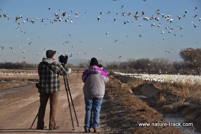
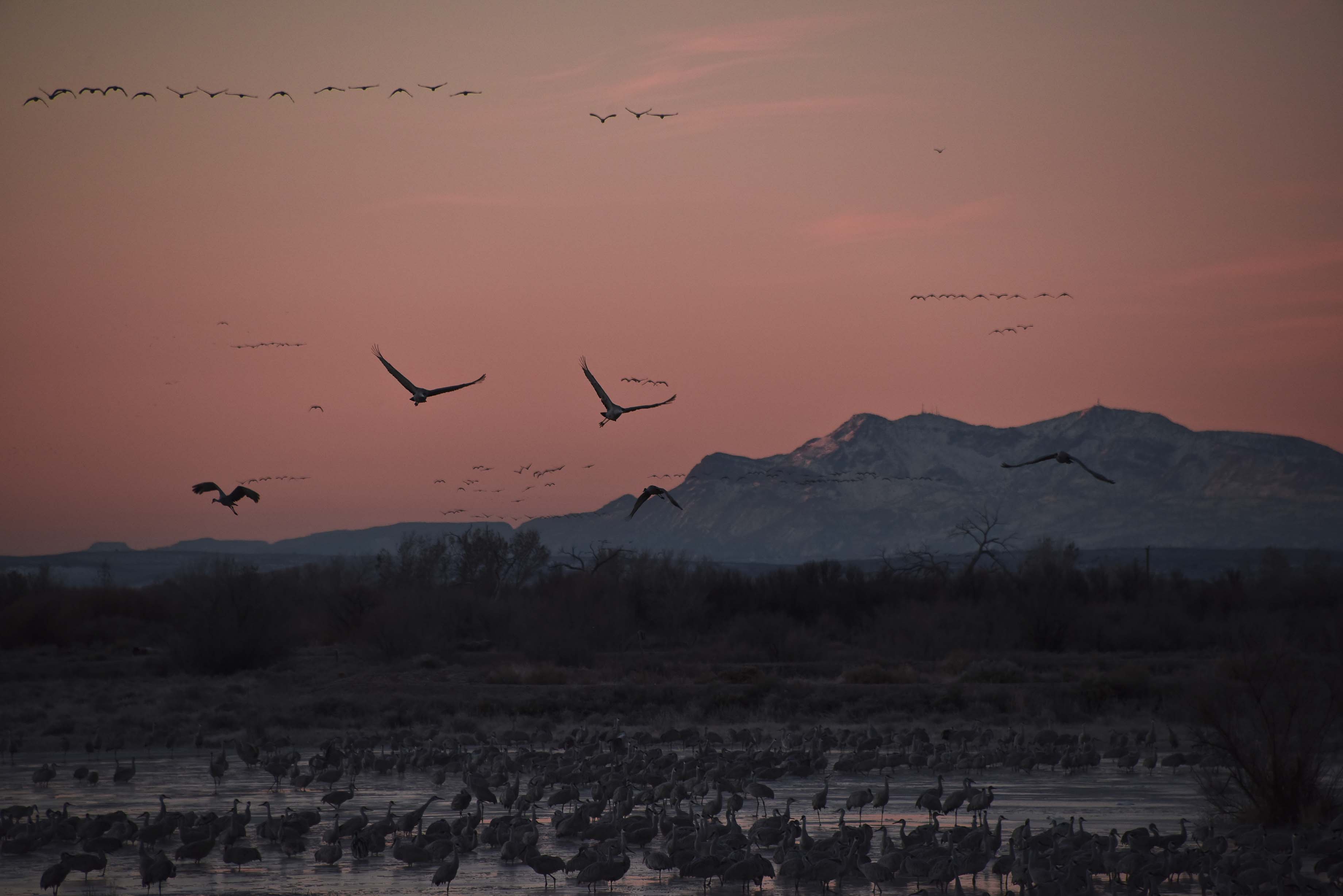
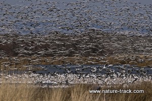
We decided to take the morning of the following day and give Bernardo a shot and as it turned out, we were thrilled we did. Here we found the massive and overpowering wildlife display we had sought. There were 30,000 snow geese, possibly many more, and about 15,000 cranes. The show they put on was beyond incredible. The air moved on their wings and hummed with their calls. As they swirled in spirals around above us, it was like being in the bottom of cyclone.
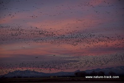
Sunrise at Bernardo was what we had anticipated at Bosque.
Bernardo is one of four parts of the Ladd S. Gordon Wildlife Complex; properties in the area dedicated to wildlife, largely the migratory cranes, and waterfowl. However, it is the one that has been designed to accommodate visitors. There are three elevated platforms and at least three blinds for close up photography and viewing. The one way route is about three miles long and when the birds are active you have a 360 degree viewing opportunity.
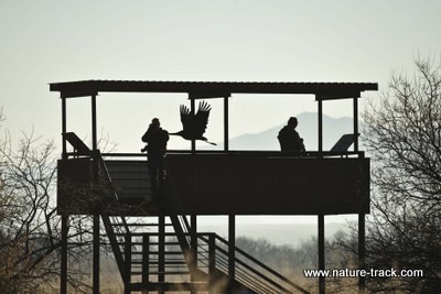
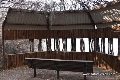
The accommodations for wildlife viewers and photographers on the Bernardo segment is amazing.
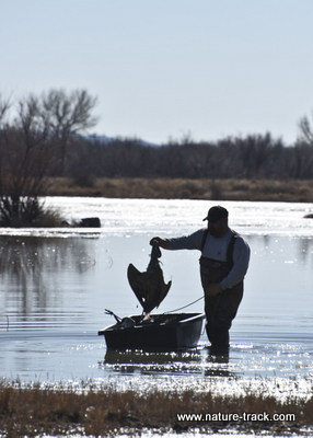
There are interpretive signs explaining the workings of the WMA and the waterfowl. However, we got our best information from Mike Chavez, a wildlife technician on Bernardo. Mike was wading through the water in mid day pulling a jet sled and picking up dead cranes. He said that stress gets to them and he picks up half a dozen or so most days. Mike was also the one who told us how many birds there were there and the fact that the Bosque corn crop had not done as well as the Bernardo crop and that is why the birds were north of Bosque. He also proudly mentioned that his father had managed Bernardo for 35 years and he was in line for promotion to assistant manager. He hoped to follow in his father’s footsteps one day.
Why the people at Bosque Del Apache NWR didn’t volunteer the information about Bernardo or why they didn’t know the reason why the birds had short-stopped 30 miles north is a mystery to me. Again, it makes me a believer in checking the internet before traveling.
Bottom line is, if you ever make the trip to Bosque Del Apache during the winter don’t forget to check out Bernardo as well. It is easy to find: heading north on I-25, take exit 175 and make a little jog left at the bottom of the ramp onto U.S. 60, basically the frontage road on the east side of the interstate. A couple miles north you will see the sign and will make a right turn over the railroad tracks.
January 12, 2016
White Sands National Monument
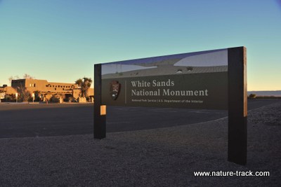
Imagine a national monument established smack dab in the middle of the Idaho National Laboratory and you might have an idea of what White Sands National Monument has to deal with. It is a 245 square mile monument completely surrounded by the massive 3200 square mile White Sands Missile Range.
We hauled out of Tucson yesterday about 3 p.m. and headed for Las Cruces, New Mexico, home of New Mexico State University. We pulled in well after dark and prepped for an early start to White Sands to catch the sunrise. In our study, we found that this monument doesn't open to the public until 7 a.m. and closes at 5 p.m. That doesn't leave much opportunity for sunrise and sunset photography. You can get a permit if you apply three days in advance and are willing to pay $50/hour (I assume you have to pay for an escort).
That is unique in the National Park system as far as we know. It has been our experience that most are open 24/7, although camping is usually permitted only in designated sites. If you want to catch a sunrise or hang around for a sunset or even a moonlit walk, no problem. Not at White Sands. When we questioned the visitor center personnel they told us it is because of the missile range restrictions. Homeland Security has made it to the National Park Service, I guess.
We missed the sunrise, partly because we didn't account for how much further east we had traveled. The rest was due to me being lazy. It was still a beautiful blue sky morning. It was also another cold morning, at 18 degrees F. White Sands sits at about 4200 feet, not much lower than Idaho Falls. It did warm to about 50 degrees F. by noon though and that was very pleasant.
As we approached the monument, we could see a mountain, Sierra Blanca (White Mountain), in the distance, totally blanketed in thick snow. As we looked our over the dunes, we seriously could not tell if there was snow on them or if that was just the white sand. It is so deceiving! We even found out that movie makers have actually gone there to film when they needed to simulate snow!
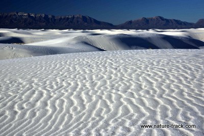
It is impossible to tell the sands of White Sands from the snow on Sierra Blanca mountain far in the distance.
There is an 8 mile long drive that takes you into the dunes and to the picnic area and trailheads. There is also a nature trail but it is currently closed (has been for 1.5 years) and will remain closed indefinitely. There is also a "no stopping" rule on the first 4 miles of the road that is somewhat irritating, as traffic is almost nil.
Otherwise, these sand dunes are truly spectacular. It was worth the drive here to see them. You won't believe the whiteness and texture of the sand. They say it is so bright that even in the middle of the summer it reflects the sun's rays well enough that you can walk on the sand with bare feet.
It is easy to see from all the picnic shelters available that White Sands is a busy place at some times of the year (they claim to have half a million visitors annually). Winter, apparently, isn't one of them. We had the road mostly to ourselves until after 10 a.m. and even then it was just the occasional vehicle. There might have been 25-30 visitors when we were there.
That part was great. No competition, no one messing with my photography. On the flip side, much of the vegetation is dormant. It isn't as pretty as it could be when things are green and blooming.
Don't expect to see wildlife at White Sands. It is there, but mostly nocturnal or in restricted areas. People go to White Sands for the scenic beauty and for, believe it or not, sledding. The sand is so smooth and slick that it makes for a fun ride. You can purchase sleds at the visitor center and sell them back that same day if you want to.
Sledding, hiking, phtography and picnicking seem to be the major activities at White Sands.
We watched the 20 minute video in the visitor center and learned enough about the area to want to return in the springtime. I am saying that about most of these parks and can see that my spring will be very busy.
We are now at Bosque Del Apache National Wildlife Refuge and will be here for several days. I realize that I am behind on a blog about Saguaro National Park and hope to get caught up soon.
Hi from White Sands National Monument!
January 11, 2016
Arizona-Sonora Desert Museum
If ever there was a misnamed place, it is the Arizona-Sonora Desert Museum. Now, I know what a museum is: a place full of old stuff or possibly preserved dead things. Well that doesn't describe ASDM at all. Not even a little bit. This place is vibrantly alive in every sense of the word with no museum qualities about it at all.
That is an issue because we just about opted out of visiting it because we prefer living things to museums when time is short. Fortunately, I happened to pick up a brochure at Tohono Chul Botanical Garden that convinced me that my perception of ASDM was wrong and it deserved our attention. We changed our plans and spent an extra day in Tucson to visit it.
Arizona-Sonora Desert Museum is located near Old Tucson, just a few miles from the west Saguaro National Park Red Hills Visitor Center. It takes about 45 minutes to get there from Tucson proper.
Our day started in the reptile-invertebrate house where a docent was calming stroking a bull or gopher snake. We looked at and photographed the 18-20 species of snakes, several frogs, chuckawallas, a gila monster and salamanders along with some pretty cool desert invertebrates like tarantulas and funnel spiders.
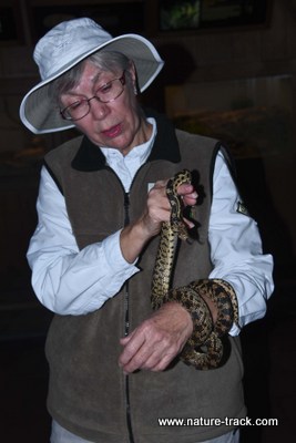
Docent Betty Eppler shows off a gopher snake that was enjoying the warmth of her arm on a cool morning.
Then we were off to a free flight bird show. This was the first time I saw one of these in a truly natural setting. In fact, the show ended early when the prairie falcon refused to come back into its cage. The trainer explained that it had had a fracas with a wild red-tailed hawk yesterday and was anxious to protect its territory from this interloper.
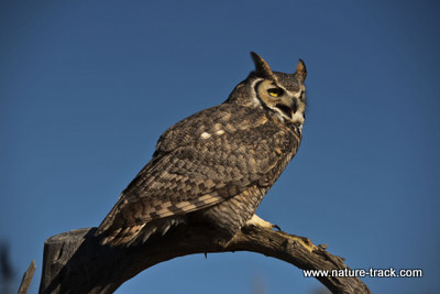
The raptor live show actually included Sonoran ravens, this great horned owl and a prairie falcon.
After that we wandered around what is essentially a large zoo with naturalized enclosures. We saw javelinas, Mexican wolves, desert bighorn sheep, prairie dogs, vultures, coati, and more. What you won't find here are elephants, grizzlies or monkeys. This area is dedicated to wildlife and plants of the Sonoran Desert, and that made it all the more interesting.
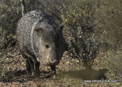
While we did see a road-killed javelina in Tucson, we have not seen one in the wild so seeing this one in a natural setting was great.
With that said, there is a hummingbird house, a walk-in aviary, a live mammal theater,and a small aquarium (this is a desert, after all, and water isn't prevalent, although it did include species from the Gulf of California since the Sonoran Desert is on both sides). The hummingbird house and the aviary offered a lot of opportunity to see and photograph native species.
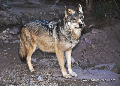
The chances of seeing a Mexican wolf in the wild are somewhere between zero and none. This was our only opportunity and they put on a good show.
This isn't the largest zoo in the world. It is 21 acres with about 2 miles of paved trails. There is a lot of up and down though and even a man-made cave. A gift shop and two restaurants round out the facilities at ASDM.
Unlike Walmart or Home Depot where you can't seem to ever find anyone to answer a question, there were several dozen docents who were ACTIVELY providing advice to visitors and explaining biology to anyone who would listen. One saw my camera gear and suggested, without me asking, that I might find the most active animals on the Wildlands loop. Another was explaining vulture culture, others pointed out hummingbirds and provided directions.
Some docents have donated over 15,000 hours of service. That is over seven years of full time work!
The only drawback on our visit was our timing. January is a bit cold for most of the reptiles and for some of the other animals. Also, few of the plants were in flower. I think a return visit in mid to late March would be ideal.
Arizona-Sonora Desert Museum is a classic example of not judging a book by the cover. We would have missed a very enjoyable day had we let the title, museum, continue to mislead us.
January 10, 2016
Tohono Chul
Finding interesting nature things to do in a city hasn't been the challenge we thought it would be. Here in Tucson, AZ, we visited a small botanical garden called Tohono Chul where we found wonderful garden trails and wildlife to enjoy.
Unlike Yuma West Wetlands, Tohono Chul is a fee site. The money is used to maintain the gardens and pay employees. It is worth the money though as it is a very pleasant place to spend a morning.
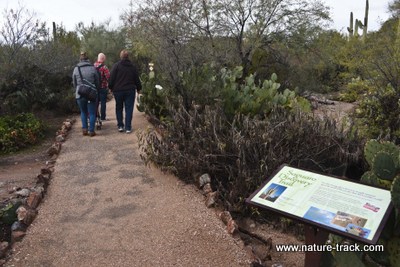
There are a lot of trails and several separate gardens to explore at Tohono Chul Botanical Garden.
One of the things that I enjoy about botanical gardens is the fact that they label the plants so you can learn to identify them.There are also signs explaining the natural history of various desert plants and animals.
We saw a lot of birds, including a male cardinal, which was a big surprise to us. I didn't know cardinals were in Arizona. We also picked up several new birds including the phainopepla. A rufous hummingbird gave us a great show in the wildlife garden.
This female phainopepla was a first for us. It is a bird only found in the southwestern deserts. The male is almost jet black and both have red eyes.
We had glimpses of cottontail rabbits several times but it was too cold for the reptiles that apparently abound on the grounds during warmer weather.
While I wouldn't want to spend all my time outdoors in places like West Wetlands and Tohono Chul Botanical Garden, I do enjoy places like these and seek them out whenever we are traveling.
Yuma West Wetlands
January 8, 2016
I didn't think we would have much of a chance to touch base with nature while we were in Yuma, AZ. As it turns out, we had a couple of opportunities to visit a modest- sized park called Yuma West Wetlands, and enjoy some birding and bike riding.
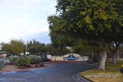
There is a really nice bike trail that pretty much follows the Colorado River and we rode it from West Wetlands to Gateway Park. Despite the rain (yes it does occasionally rain in Yuma) we enjoyed the ride and wished for more time to explore it.
We really enjoyed the birding, especially watching and photographing the Costas hummingbirds. There is a hummingbird garden there and probably a dozen hummers were helping themselves to the nectar-laden flowers. There are supposed to be four species of hummers that use the park be we have only seen Costas. I would like to spend more time there and see if I can find the other species.
We also saw mockingbirds, grackles, herons, mourning doves and several as yet unidentified species. A highlight was the roadrunner pointed out to us by Kimberly, one of the groundskeepers. She showed us some of the photos and video she has taken on her cell phone and then proceeded to show us the plants that she so lovingly cares for. She explained how the birds use the plants and had us test the scent of several.
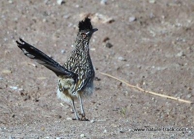
This roadrunner literally feeds at Kimberly's feet. He was a little more wary of us though.
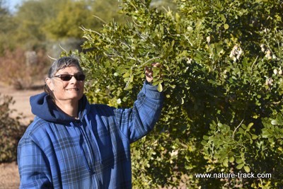
Kimberly, a recently graduated Master Gardener, stands next to a Texas Mountain Laurel. She told us all about the life history of the plant and others in the park. Kimberly epitomizes what an employee should be: excited, informed and happy to share.
We had found the West Wetlands Park several years ago while visiting in Yuma. We just got on a birding site to see what was available. The lesson from this little excursion is that you can find lots of opportunities to enjoy nature, even in cities and places where you are less familiar with the terrain. Just use the internet and do a bit of research.
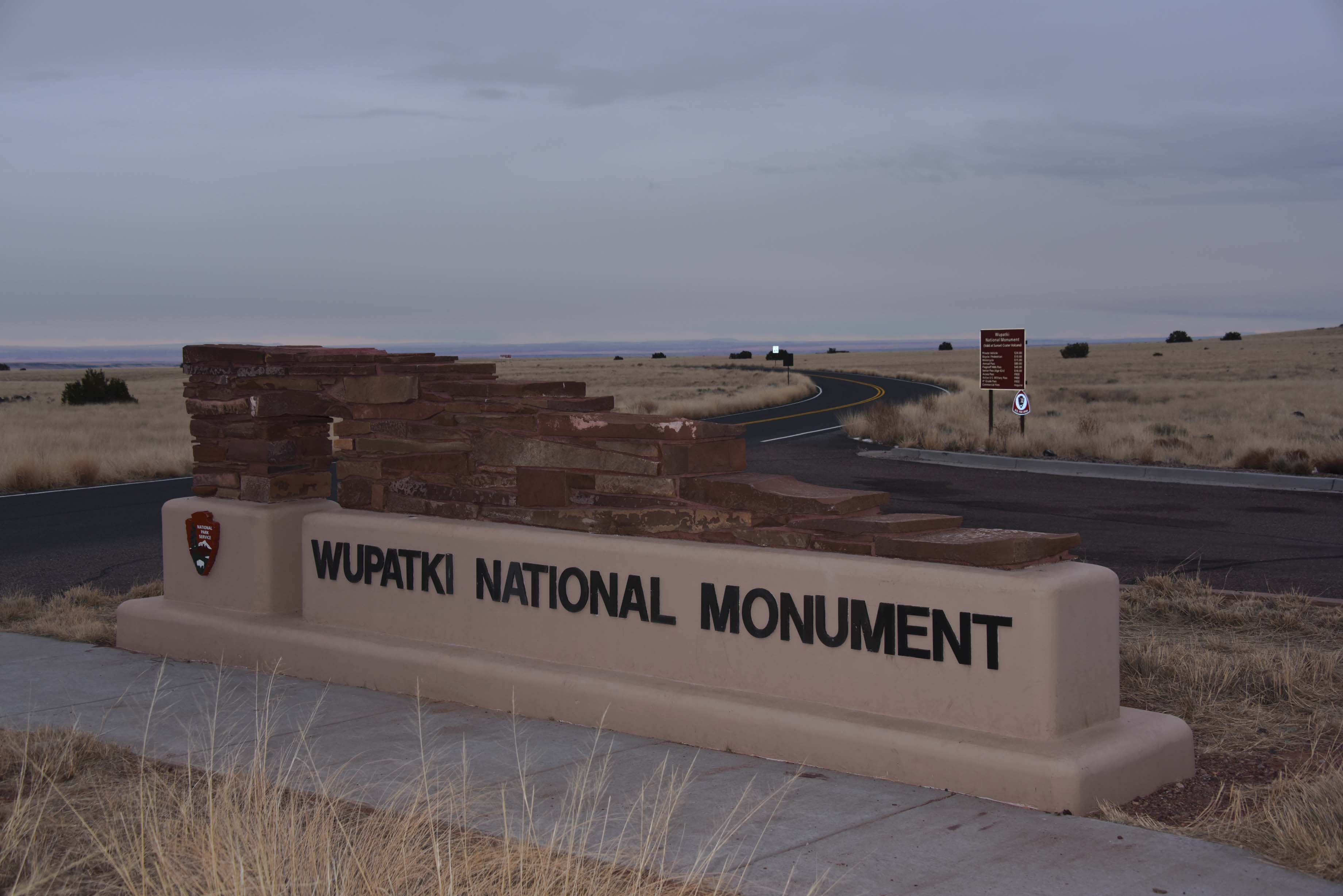
Wupatki National Monument
January 4, 2016
Our sunrise luck ran out this morning as the predicted snowstorm began to develop. The Canyon was full of clouds and snowflakes plastered the windshield well before dawn. We gave up and headed south toward Flagstaff, with an ultimate destination of Yuma, AZ where we will help my dad and step-mom for a few days (there might be a hiatus in this blog during that time).
All was not lost though as we had several possible stops to make along the way. The first was Wupatki National Monument about 25 miles north of Flagstaff, AZ. We hadn't done much research on this monument and weren't sure what to expect. We were pleasantly surprised to find 71,000 acres dedicated to preserving the culture of a people who lived there 800 years ago.
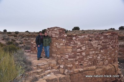
We are standing at Box Canyon Pueblo.
The puebloan people left behind some pretty amazing structures. As Cathy pointed out, it is doubtful that our modern house is going to stand for 800 years, yet these structures have. Sure, they aren't intact, but they are certainly still impressive and from a distance look like they still might be occupied.
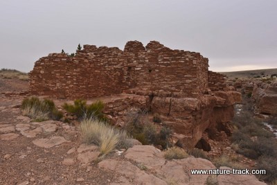
Lopaki Ruin is just a few hundred yards from the Box Canyon Ruin.
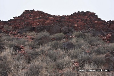
Citidel Ruin sits high on a mound and has many rooms.
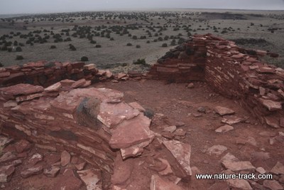
Athough in ruins now, there was once a thriving community here. From the top of the Citidel, you can see at least eight additional ruins.
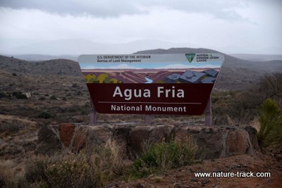
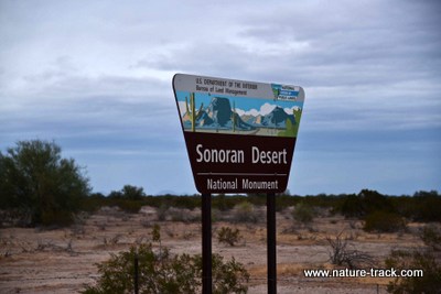
Wupatki National Monument is managed by the National Park Service. However, we went to two other monuments that are managed by the BLM: Agua Fria National Monument 40 miles north of Phoenix on I-17 and Sonoran Desert National Monument between Maricopa and Gila Bend on State Road 238. Unlike monuments that we might be accustomed to, these are essentially devoid of services and should be considered remote and wild. They both look like places deserving of more attention but we were pressed for time and flash flood warnings from the continuing rain kept us moving on through.
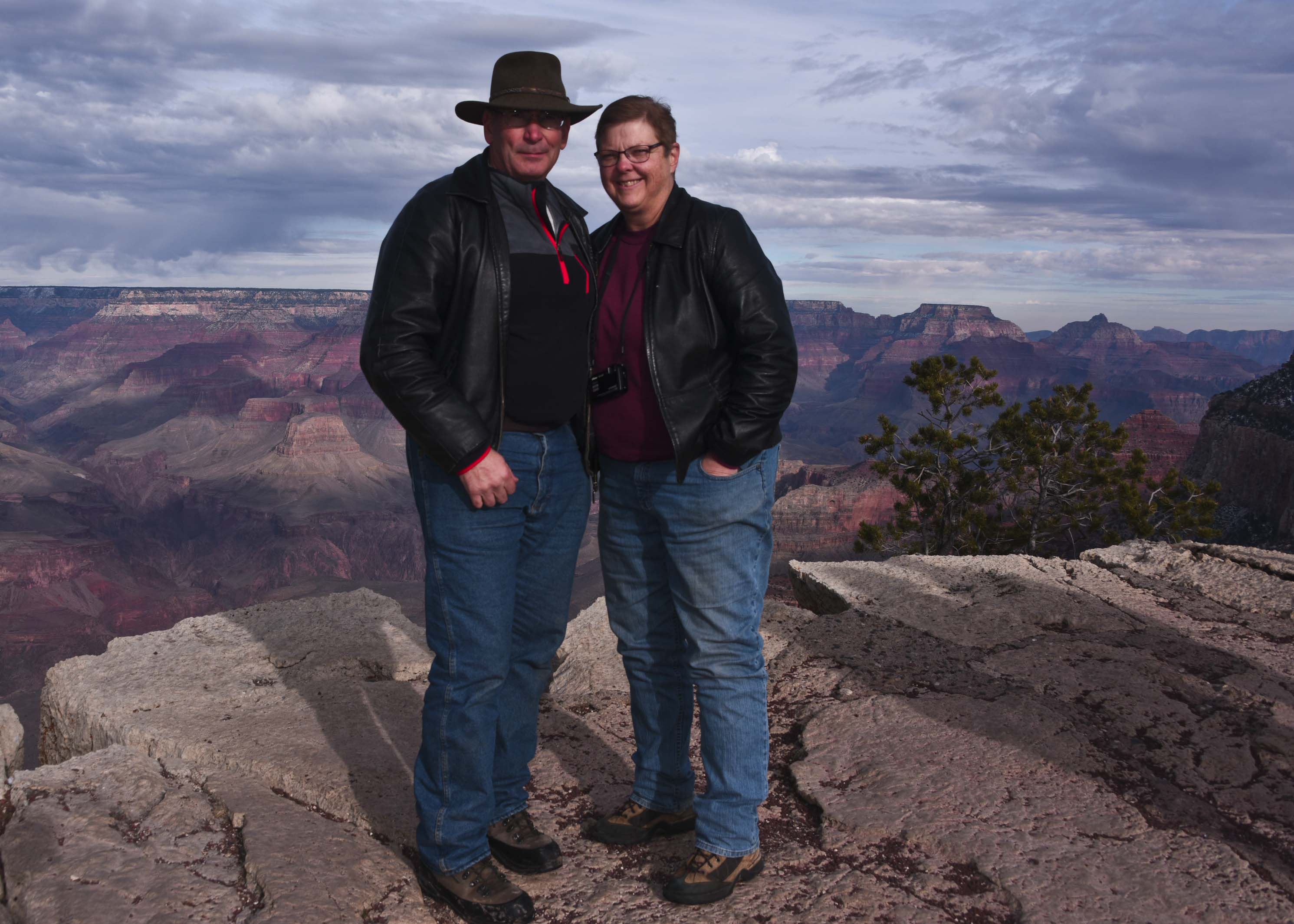
Grand Canyon National Park
We really lucked out with another sunrise this morning. We were at Mather Point on the South Rim of Grand Canyon National Park. Clouds at the eastern horizon looked like they were going to obscure the sunrise but the sun was able to duck underneath at the critical time and give us a spectacular show. It was short-lived but it was great!
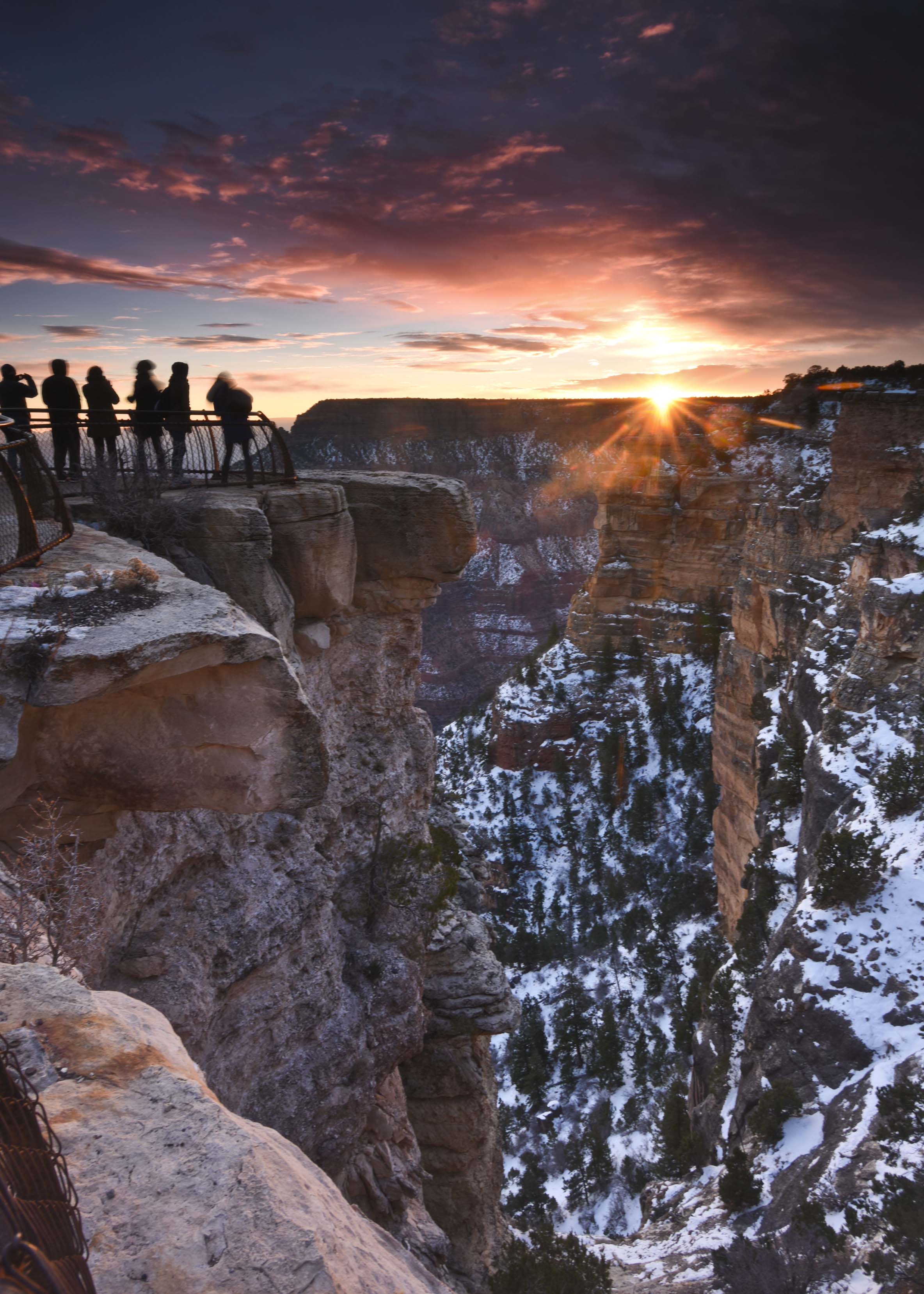
Sunrise at Mather Point. This is a great place for sunrise and sunset photographs.
It was surprisingly busy in the Park today. I would guess a thousand or more visitors. Most were from foreign countries. We must have heard "wow" and "awesome" in a dozen different languages! One thing that we have noticed in both parks is the popularity of "selfie sticks", those telescoping poles that can hold a cell phone on the other end and let you hold the phone (camera) further away.
We also noted that the younger generation is apparently fearless. They would often stand right on the edge of a precipice and have someone take their picture. I could hardly stand to watch!
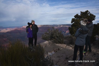
These kids are standing right on the edge of a very tall cliff! I could hardly even stand to watch them. The wind was blowing hard in their faces and all it would have taken was an extra strong gust and, Whoops! It was amazing what they would do for a photo of themselves.
It was 28 degrees this morning, a full 36 degrees warmer than our first morning at Bryce. However, a stiff wind made it actually seem colder and everyone in the park was bundled up (except for one teenage girl in a skirt). We were glad to be able to get in shuttle buses, visitor centers and the truck often to warm up.
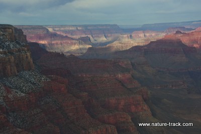
There are no loser views in Grand Canyon. It is beyond awesome, and as Teddy Roosevelt said, every American should see it.
We did take a break about one o'clock and headed into "The Village" to attend Church. It was good to get take a break and do something normal.
We have found that this Park is much too big for a one day or even two day visit. We did not even get on a trail today as we spent most of it checking out the myriad overlooks. This isn't a bad way to start a trip as it helps in planning the rest of the trip. However, it is frustrating to see a lot of incredible potential activities and know that there just isn't time this trip. I guess it gives us an excuse to come back.
Bryce Canyon National Park
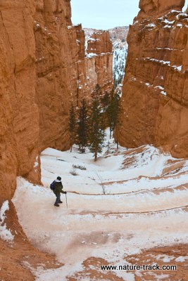
January 2, 2016
Compared to yesterday, today's sunrise at Sunset Point was balmy. It was a whopping 21 degrees above zero! Almost 30 degrees different than yesterday. We paid for that comfort though with a lackluster sunrise mostly blocked by a leaden cloud layer overhead. It did let a little color seep through right at the horizon line but there were a lot of disappointed photographers and sightseers.
Today we headed down into the hoodoos (that is what the rock formations are called). We went on the Navajo Trail right off Sunset Point. The trail, even with switchbacks, was steep, icy and slippery. We used our metal pointed walking sticks and wished we had cleats. We made it to the bottom without mishap though and thoroughly enjoyed seeing the Park from this angle. Now, instead of looking down on the rock formations, we were among them and looking up. It is a completely different experience. You also quickly enter into (sparsely) forested habitat with Ponderosa pine, Limber pine, junipers and several trees I should know but couldn't put a name to.
The climb out was not nearly as slippery as the trek down and if I hadn't stopped to take a photograph about every ten feet, we would have made it out quickly.
Anticipating a long drive to the Grand Canyon South Rim today, we changed to traveling clothes before we went to the visitor center. The visitor center is smaller than I expected, but that is partly because the display area was under construction. It is due to reopen on January 16th.
Cathy picks her way carefully down a series of ten switchbacks on the Navajo Trail
When you enter the Hoodoos, you get to see details like these 2 natural bridges, that you just can't see from the overlooks.
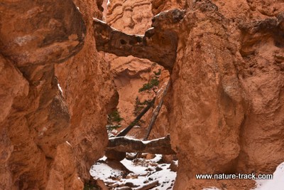
We finally got to see Red Canyon, along Highway 12, in the daylight on the way out. Once we dropped off the plateau the sun was shining and we discovered that Red Canyon is almost as cool as Bryce. It is definitely a place to come back to and explore more thoroughly.
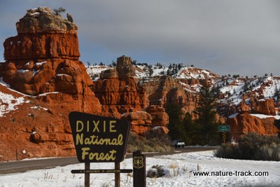
Red Canyon is an amazing place with hiking and bicycling trails and a visitor center (closed in winter). It is well worth a day of exploration and photography.
We ate lunch at the Thunderbird Restaurant in Carmel Junction and then drove onto Kanab. Outside Kanab, we drove down to the townsite of Paria, where many westerns were filmed. The last film made there was, The Outlaw Josey Wales, starring Clint Eastwood. It was interesting to note that this place is within the Grand Staircase-Escalante National Monument. When we were looking out from Sunset Point, we were looking across the Grand Staircase. At 1.9 million awesome acres, it is another place we are going to explore more thoroughly in another trip.
Paria townsite (aka Pahreah) is deep within the Grand Staircase-Escalante National Monument. This Monument, easily seen from Bryce National Park, deserves a lot more exploration.
A little later, we were at Wahweap, near Page, Arizona, staring at Navajo Mountain, the same mountain we watched the sun rise from behind yesterday. It was 80 miles away then. Now it seemed so close we could almost touch it. That was pretty cool.
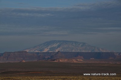
Navajo Mountain as seen from Wahweap near Page, AZ. In the photo below, the sun is rising to the left side of Navajo Mountain.
January 1, 2016
From Bryce Canyon National Park we watched the sun rise over distant Navajo Mountain this morning. It was a glorious morning despite the fact that we were in the grip of the same cold front that is plaguing much of the West. At Sunrise Point, it was 8 degrees below zero, but the sky was clear and the rising sun made it seem warmer. All in all, it was a great way to start the new year!
Getting to Bryce was easy. It was a straight shot down I-15 to Exit 95, then east on State Highway 20 to Highway 89, then about 10 miles to Panguitch, UT. From there it is only about 30 minutes to Bryce.
Of course, today being the New Year and a federal holiday, the visitor center was closed. However, we'll return tomorrow and take a quick look before moving on to the Grand Canyon. Despite the fact that few Park Service employees were out and about today, we found Bryce to be a very visitor friendly place, even in winter. They even had a heated bathroom with flush toilets, both welcome amenities when compared to an outhouse with a toilet seat that could freeze to bare skin!
Naturalist Notes is dedicated to helping you get the most from every experience in nature. Follow us to learn about the intricacies of the natural world and for tips on gear, books, places to go, things to see and things to do in the great outdoors. Help us to create the premier site for naturalists.
Scroll down for what's new in the Nature Community and what's new to this website.
Wildlife Management Areas
Wildlife management areas, like Market Lake Wildlife Management Area above, are essential for wildlife conservation in Idaho. They also provide wonderful areas for recreation for wildlife enthusiasts. Find out all about Idaho's Wildlife Management Areas...click here
Read my recent column on the importance of WMAs here
Nature Collecting is a Fun Hobby

Wandering in the woods, I happened to notice a few old bones scattered about. Not one to let such valuables go unexplored, I poked around, picking up a femur from under a snowberry bush, and digging out a portion of a partially buried, moldy jawbone from the hard ground. These I inspected, admiring the complexity of the skeletal system, and then set them back down.
Further searching netted a real treasure—a vertebra, as large as my hand, weathered but intact. Read more
Owl Pellets
In my wanderings today, I picked up a more than a dozen barn owl pellets. I suppose a couple would have sufficed, but I just couldn't help myself. They were like gold nuggets just laying there on the ground!
I love owl pellets. They not only reveal that an owl is frequenting the area, but they also provide a good record of what small mammals live there too. Read More
Chronic Wasting Disease

Is chronic wasting disease still considered a critical issue for wildlife management? I found out.
Carbon Monoxide Part 2

Where does carbon monoxide come from and how can we stay safe from this silent killer?
Carbon Monoxide

Carbon monoxide is a deadly silent killer, but we should be safe from it when we are outdoors, right? Wrong.
Winter Preparedness Part 2

You need to have your vehicle ready with tire chains and other gear, but what should you carry for the people in your vehicle?
Winter Preparedness

Being prepared for emergencies is a must if you are going to drive in snow country. What equipment should you have?
Weather Advisories, Watches, and Warnings

Paying attention to weather advisories, watches and warnings is one way to stay safe this winter.
Continue reading "Weather Advisories, Watches, and Warnings"

Mutualism

Mutualism is a specific kind of symbiosis where both species in the interaction benefit from their association.
Symbiotic Relationships

What is the difference between the symbiotic relationships of commensalism, mutualism, parasitism?
Paint Colors in the Woods

There are strange paint markings on many trees in our woods. What do they all mean?


Chernobyl 40 Years Later

The Chernobyl nuclear disaster happened 40 years ago. What has happened since then?
Life After Dark Part 2

Adaptations that allow wildlife to thrive at night are many. Learn about a few here.
Convection Heat
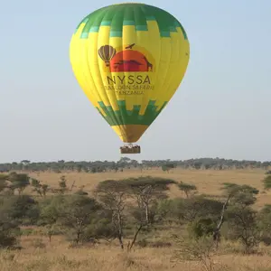
Convection heat transfer is very important for maintaining body heat and for life on Earth as well.
Heat Part 2
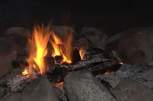
Thinking of heat as energy is helpful when trying to visualize how heat influences our lives outdoors.
Heat

Heat. We use it every day, to cook our food, for warm showers, to bask in sunny rays at the beach, and as winter steadily approaches, to maintain our homes at a livable temperature. We use heat so often we likely take it for granted.
Earth rotational Axis
The rotational axis, tilt, of the Earth is surprisingly, not a fixed number. Over time it fluctuates and wobbles.
Vultures
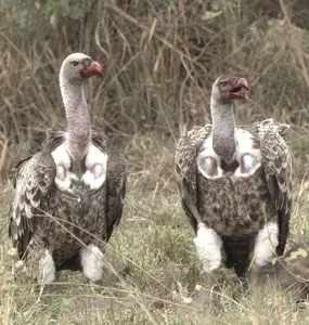
Vultures are an essential part of Nature's clean-up crew. You might be surprised at the different types
Wallace Line

Why are the animals and plants so different on opposite sides of what is called the Wallace line?
Biogeography

How did plants and animals end up where they are and why? are questions biogeography tries to answer.
Conservation Dependent

If a conservation action will only work if the action remains in place, it is sometimes called conservation dependent.
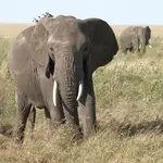
Memory

Memory is a precious thing, one of the essential things that makes us human. How does it work?
Bacillus Thuringiensis
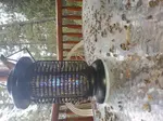
Bacillus thuringiensis is a natural bacterium that can selectively kill insects such as mosquitoes and moths. But is it safe to use and are there alternatives?
Greater Yellowstone Ecosystem
The Greater Yellowstone Ecosystem is a unique place where Yellowstone National Park is just a part of it.
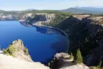
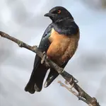

"WOW. What a phenomenal piece you wrote. You are amazing." Jennifer Jackson
That is embarrassing, but actually a fairly typical response to my nature essays. Since The Best of Nature is created from the very best of 16 years of these nature essays published weekly in the Idaho Falls Post Register (online readership 70,000), it is a fine read. It covers a wide variety of topics including humorous glimpses of nature, philosophy, natural history, and conservation. Readers praise the style, breadth of subject matter and my ability to communicate complex and emotional topics in a relaxed and understandable manner.
Everyone can find something to love in this book. From teenagers to octogenarians, from the coffee shop to the school room, these nature essays are widely read and enjoyed.
Some of the essays here are my personal favorites, others seemed to strike a chord with readers. Most have an important message or lesson that will resonate with you. They are written with a goal to simultaneously entertain and educate about the wonderful workings of nature. Some will make you laugh out loud and others will bring a tear to the eye and warm your heart.
Readers Write:
"You hit a home run with your article on, Big Questions in Nature. It should be required reading for everyone who has lost touch with nature...great job!" Joe Chapman
"We enjoyed your column, Bloom Where Planted. Some of the best writing yet. The Post Register is fortunate to have your weekly columns." Lou Griffin.
To read more and to order a copy, click here or get the Kindle version
Copies are also available at:
Post Register
Island Park Builders Supply (upstairs)
Barnes and Noble in Idaho Falls
Harriman State Park, Island Park
Museum of Idaho
Valley Books, Jackson Wyoming
Avocet Corner Bookstore, Bear River National Wildlife Refuge, Brigham City, Utah
Craters of the Moon National Monument Bookstore, Arco, Idaho
Wildlife License Plates
Great news! as of 2024, there are three NEW designs for license plates. They still are bluebird, cutthroat trout and elk, but they are beautiful.
Idaho Wildlife license plates provide essential funding that benefits the great diversity of native plants and wildlife that are not hunted, fished or trapped—over 10,000 species or 98% of Idaho’s species diversity. Game species that share the same habitats (such as elk, deer, antelope, sage-grouse, salmon, trout) also benefit from these specialty plates.
No state tax dollars are provided for wildlife diversity, conservation education and recreation programs. Neither are any revenues from the sale of hunting or fishing licenses spent on nongame species. Instead, these species depend on direct donations, federal grants, fundraising initiatives—and the Idaho Wildlife license plates.
Both my vehicles have Bluebird Plates. I prefer the bluebird because the nongame program gets 70 percent of the money from bluebird plates, but only 60 percent of the money from elk and trout plates - 10 percent of the money from elk plates supports wildlife disease monitoring and testing programs (to benefit the livestock industry) and 10 percent from cutthroat plates supports non-motorized boat access.
Incidentally, in 2014, the Idaho Legislature denied the Department of Fish and Game the ability to add new plates or even to change the name of the elk and cutthroat plates (very specific) to wildlife and fish plates, a move that would have allowed for changing images occasionally and generating more revenue. It would seem that they believe that we Idahoans don't want a well funded wildlife program.
I think it is time we let the Legislature know that Idahoan support wildlife funding and that we would like to see these generic plates come to fruition.